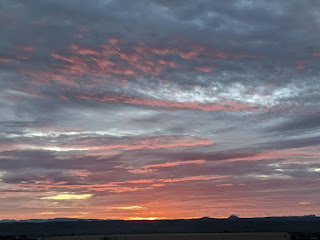
I slept good. I had stopped at a truck stop in Lemitar, NM with a direct view of the sun rise. The sky was still very cloudy and it remained so all morning, allowing me a cool walk in Truth or Consequences (Palomas Hot Springs) off I-25. ToC is a small town of just 6000. I like passing through this town on road trips because it has all the amenities, but this morning the Black Cat Coffee shop was closed and the microphone at the McDonald's drive-thru wasn't working well so I drove off from the drive-thru with no coffee to start my day. Drinking Diet Pepsi gives me some caffeine, but it's just not the same.
I googled the town for any parks along the Rio Grande and found Rotary Park, a primitive green space to launch rafts from. I figured I'd do whatever trail there was, no matter how short. I was in luck. A sign prominently posted in the parking area showcased the "Healing Waters Trail" but there was no mention of its length.
I decided to explore this part, crossing a metal bridge over a pond before continuing uphill. The trail never gets to the river, just near it. I needed to walk a bit to loosen my body after sitting in the Honda for so long.
People were already fishing from the banks as I walked past. Rafters were getting their gear ready for the river, which was following nicely. The storm from last night had washed more debris across the trail. It's not a developed area, but it's a good place to start the Healing Waters trail, among the smells of the desert and the sounds of rushing water. This trail is not listed in Alltrails.com, perhaps because it is an urban trail for most of its route.
I climbed up a small hill, walking up still very damp sand. The hill felt brittle, as if it would collapse into the river at any time. The trail is lined with large rocks and railroad ties, many which have rolled downhill. The trail here could use some maintenance but it's mostly easy to follow.
Metal stairs took me up a steep section which Zeke refused to take. The Carrie Tingley Veterans Hospital is at the top of this hill. Tingley established this clinic initially for "crippled children." It's now a Veteran's Hospital.
I stopped to read all the historical markers along the way. The town became popular through its hot springs 100 years ago, but seems to have fallen on hard times more recently. An older woman in a plaid blue shirt passed me by quickly. I never could catch up to her as she walked with a purpose. We didn't exchange any greetings.
I topped out at the hill by the Veteran Memorial before continuing on South Broadway's sidewalk going into the historic district. The natural trail now gave way to city pavement and loud traffic. While I love history of all kinds, the calming, natural part of the trail was now over.
I enjoyed the river area, but walking on that sidewalk so close to traffic was not my cup of tea and I cut this walk short. I don't mind urban trails, but this one was too loud for Zeke and I didn't enjoy trucks roaring so close to us.
I took a residential street back to where I parked, passing by some yards that looked like they came out of Bisbee. Dips in the streets were filled with water, which ravens were using as their bathwater. We had walked 2.6 miles and the sky was still cloudy, with darker clouds east of the Rio Grande. A local man was out holding anti-Trump signs across from the dog park. I stopped at the dog park but Zeke showed no interest in other dogs. It was time to move on.
I continued on via S I-10, then took NM152 into Hillsboro, over the Black Range and into Silver City. This area took a brutal hit during a 2005 wildfire. Treeless hillsides are still visible. This is a scenic drive but definitely no short cut, as some of the curves require one's full attention. Clouds were looking stormy when I reached the 8228' Emory Pass. I've always wanted to spend some time in this mountain range, as there are many trailheads accessible right off NM152.
I stopped at the Lower Gallinas trailhead and walked the creek dowhill for 1.2 miles. constantly in the cool shade. It was a different story once I made it into town, when that cool 67F became 83F.
Silver City is taking covid seriously. People were wearing face masks while walking down the street. Even the Toad Creek Brewery has limited hours. My dinner was a mediocre combo meal at Del Taco and then I decided to try the Dragonfly trail on the east side of town. I did this two years ago with Sadie and never did see any petroglyphs. Today I walked the trail counter-clockwise and still didn't see any. The creekbed was dry, too, despite last night's rain. This is a pretty trail with minimal elevation gain that one can take into the wilderness to other trails higher up. Alltrails says it's 3.2 miles but again I got more than 4 miles. My GPS read 6.9 miles with all the exploring I did again.
I wanted to hunker down in Silver City for the night and then opted to leave and camp in the Chiricahuas for the night, with a possible last hike there before heading home. I left the area at dusk, wishing now I had left earlier to catch the sunset over the Chiricahuas. I must make Silver City a long weekend destination, as there are so many trails I still need explortng in the Black Range


No comments:
Post a Comment