Distance: 11 miles o/b
Elevation gain: 6572'-9466'
Time: 7.5 hours (not a personal best!)
This 11-mile hike is becoming an annual event for me over the MLK weekend. I did this hike two years ago with all three dogs from Lutz Canyon. I did it again last February when Hannah lead the hike. With Carr Canyon Road closed until mid February and Carr Peak off limits, Miller was my peak for the month. I opted to hike it from Montezuma's Pass this time to start out on a dry trail. I expected heavy snow further up.
Today I only did it with Sadie, and had a late start. I had asked via my Facebook page if anyone else was interested in hiking with me, but I got no replies. It was my bad; I didn't plan on this hike until Friday, right before a long weekend. Hiking alone provides solitude, but hiking with a companion gives me an added boost.
I started even later than planned because once at the trailhead parking lot at Montezuma's Pass, I got carried away with several people mingling there. I talked to two young women from Phoenix whose car's radiator leaked just as they pulled up next to me. The radiator was boiling over and I told them to wait before opening their hood to avoid getting hit with boiling steam. A caver from Las Cruces NM with a Canon 7D who enjoys coming here looking for caves was also parked nearby. According to him, there are plenty of unmarked caves all over the Huachucas. I chatted a while but knew I had to get going. I was the only one, it seems, who parked to hike up the Miller Peak trail.
I finally got going at 10:15am and didn't even make it to the wilderness boundary until 11:30am. I don't remember it taking me this long last time. I felt overheated, thirsty and out of shape all day today.
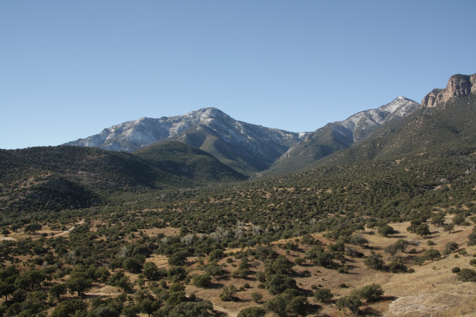
It was a lovely day for a hike. Clear skies, little wind, and a peak temperature of 65F. (It was 57F on Mount Lemmon, I learned later, so this was accurate) I was dressed as if expecting deep snow. My Kaylands were almost too warm for me, my insulated nylon pants made me sweat and my knee-high gaitors made my pants wet! It didn't even take me long to take off my outer yellow jacket. I wore two sweat-resisting shirts to keep me warm. I probably could have done today's hike in shorts and day hikers.
The first two miles from the pass north along the Crest Trail are rough, going up the steep grade on the exposed south side of the mountain. Agaves (some of the most perfect I've seen on a trail), sotols and oaks line the trail but the big trees are still a ways up. On a hot day this stretch is torture. The two abandoned mines are now sealed and only the bats can come and go. I love the views from this vantage point, however. Northern Sonora is so enticing from this viewpoint.
Just past the second mine the trail levels off for a bit and the firs shade the trail. This adds a more alpine feel to the trail, and a cool relief from the exposure and grade.
Target shooters were shooting in Ash Canyon. I explored an illegal trail off the first summit and could clearly see all the trails into Ash Canyon. This is where the drug runners go.
Once officially in the Miller Peak Wilderness, the trail travels north along the eastern ridge before it crosses over to the more scenic western slope with its steep ascent. The shrubs along the trail seem to have gotten a lot taller the last few years.
We were the only ones on the trail, although I heard a few male voices north of me on the Crest Trail as I got on the Miller Peak trail. That is, if one does not count the potential illegals sneaking up through the heavily-treed creekbed. Sadie kept staring at the creekbed as if she heard people there.
I stopped several times just to get my breath. A hike I thought would take me five hours took me over seven. I must have stopped four times at 10-15 minutes each time. I felt I was rehiking Mount Whitney all over again.
Why was I so slow? Maybe I just lost my conditioning from last summer after all those months. Maybe it was the holiday flab. I also feel heavier than in November. The signs said Miller Peak was 5.5 miles from the trailhead. Other reports say it's only nine miles round trip. I tend to favor the signs. It sure did feel steep.
The mountains had received several feet of snow during the New Year's Eve blizzard. However, most of the snow was packed down and there were plenty of dry areas. The only real difficult area was north of the Lutz Canyon trail section, where the snow and ice had packed deeper and developed ice. This slowed me down. It didn't slow Sadie down, except for when she had to wait on me. She'd bite into the snow for water.
I finally made it to the peak at 2:20pm. I couldn't call Kevin as I had no phone reception. The peak was remarkably calm with no wind. It was actually nice to sit down and gaze toward Mexico, and I took my time. I love the views into Mexico from Miller and Carr Peak. How I wish I could travel worryfree into Mexico! I looked over northern Sonora and rued all the violence in that country. I saw the small lakes I explored with Mike and Tone two years ago, the headwaters of the San Pedro River, meeting the Mexicans and looking at old ruins. What a shame I no longer feel comfortable going into Mexico; there is so much left unexplored now thanks to the violence the Mexicans themselves have created.
Perhaps I got lost in thought as I sat there for a while. Sadie took a nap. I finally pushed myself up to continue the two-hour descent. I knew if I waited any longer I'd be returning to the car in the dark, and that is one thing I don't want to do along the border.
I'd like to come back up to Miller Peak this summer and stay overnight for a meteor shower.
I didn't stop for a break while going downhill. I slowed down to take a few pictures but I didn't stop for water. We got back to the car at 4:50pm as the late afternoon sun cast a golden hue over the valley. I was the only car left in the lot. The two women with the busted radiator said they didn't think the drive along Forest Road 61 was very scenic. They probably weren't looking! They also didn't realize that there was a decent-sized town on the eastern side of the Huachucas; they had never heard of Sierra Vista.
Today's hike revealed no trash anywhere, even around the illegal campground just south of the Lutz Canyon trail. I was very pleased with that. I hope the mountains remain this way. Hopefully this means that there are less illegals coming across these days. I've definitely seen a decrease in mountain trash since 2008.
I was hungry when I got home. I ate a bowl of beef stew that Kevin had made and got started on my biology work. I'm going to be busy for the rest of the semester.