fer midnight sun was bright by 3:40am. I let the dogs out to pee, but went back to napping as I didn't want to break the silence. There were quite a few people in the parking area!
I finally drove off at 8:30am, taking the Top of the World highway east of Tok to Dawson City. It was by far the worst road yet on this trip: 60 miles of compact gravel road with several long delays for construction teams. By the time I got to Chicken, AK I was ready for a beer but opted not to since I still had a ways to go and was only averaging 35mph. Chicken's big claim to fame is its old gold mine. A few RV parks, a cafe and a gas station are their current economy. Both Zeke and Sadie left their poop behind near the chicken statue, so obviously we all needed a break! And yes, I did clean up after them.
I made it to the Yukon border at 1pm. The border crossing here is the most northern land crossing between the US and Canada, right in the range of the 40Mile Caribou herd, with mostly barren hillsides and spindly pines. A snowcapped mountain range was farther norther; the hills around me were steep with narrow spurs. It was compact gravel all the way to Dawson City. At least there were no frost heaves! A state ferry took us across the Yukon River. We were officially in town at 3:20pm. I parked near the river. A kayak race that started 140 miles away in Whitehorse had its first team come through at 4pm and spectators were watching from the dyke. People were laying on the park grass, playing with their dogs or just standing around mingling with others.
I walked around the town for a mile, then took the dogs on the 3.5-mile loop trail around town, starting along the river and then joining the 9th Avenue Trail. We had views of town and the river. The wooded part along the hill went through an old mining community, and with a closer look one could see relics rusting in the tall grass, old cabins decomposing among the new aspens. This is a town proud of its history and willing to preserve it. The roads are still dirt, the sidewalks in the business district are wood planks and the entire town is a noted historical site. The Visitor's Center alone is like a museum, displaying the fur trapping, gold miners and rail road workers who developed this area and put it on the map. The Robert Service cabin is preserved and next to it is the Jack London museum. Both writers wrote about the gold rush of the early 20th century and life in the Yukon.
The walk was enough for the dogs. I've noticed Sadie weakening on this road trip. I'm either just now aware of her age or I've taxed her too much on this trip. She's become an old, tired dog. The 3.5 miles were enough for her. Both dogs rested in the van as I visited a Victorian-era hostel/now hotel and pub and had one Yukon gold beer and artichoke dip with chips. The dip combo cost more than the beer and the bartender looked like a young Greg Allman.
My last deed in town before leaving was stopping at the recycling depot in town, a colorful building I discovered on my walk. I was impressed with everything that is recycled here. It's not just glass bottles, cardboard and plastic #1 and #2, but styrofoam, boxboard, milk cartons, all papers and "mixed plastics" not labeled #1 and #2. I told another woman dropping off recyclables that I admired the town for recycling everything, as one doesn't see this in the United States. "Why not?" she asked perplexed. "Because in the US we don't recycle unless it is profitable."
I drove up Midnight Dome outside of town, a popular spot for locals on summer solstice to come here and watch the sun set at midnight, then watch the sun rise again two hours later. It was
10:30pm when I made it to the dome, with tour buses and bikers looking out over the view of the meandering Yukon river as it snakes around high cliffs and disappears over the horizon. I could have hiked up to the dome from town on one of the trails off the 9th Avenue Trail, but I wanted to give the dogs and me some rest. There are still plenty of trails to hike between here and Arizona!
I drove another two hours along the road, as the tall hills gave way to more gentler slopes studded with spruce and aspen. I wanted to make it to Stewart Crossing south of Dawson City, but instead stopped 30 miles north of town at Moose Creek, a pull out just outside the Moose Creek campground. I parked there for the night with no one around but a bazillion mosquitoes swarming around the van. I had to close all the windows in the van to keep the dogs and me from becoming a meal. It got a little warm in the van with no cool air circulating, but it did cool down enough for us to get some rest.
I drove 360.1 miles today.
Friday, June 30, 2017
Thursday, June 29, 2017
Day 26 Glennallen to Tok
Spent most of the day exploring the north side of the Wrangell-St Elias National Park on the Nabesna Road. This road was only 42 miles long, 13 of it paved. We hiked the two miles up and around the Rambler Mine, with spacious views of the valley below.
More details later
More details later
Wednesday, June 28, 2017
Day 25 From Valdez to Glennallen
It was a quiet morning. I woke up at 7am to foggy skies but no rain. Sadie still looked exhausted but Zeke was ready for his morning pee walk. A .8-mile walk along a ski trail near the Mineral Creek glacial debris did the trick. A breakfast of biscuits and gravy (served with three eggs!) at the Oldtown Burgers place edid the trick. I was full as I left town. The sun broke through the clouds at times. This was the weather I had wished for yesterday. My rain coat and shoes are still very wet from yesterday's hike. The cold rain and grey clouds kept me from enjoying the beauty around Valdez, but I'm glad I got to see the place where for years the oil spill caused headlines. I wouldn't want to be here in the winter, here, as the town is locked in.


Now back north over Johnson pass, a quick walk to the Worthington Glacier was my first stop. I got to hike this glacier, even getting close to the blue-hued ice. The trails are not official trails, so there's much rock hopping and climbing, but I stuck to the easier routes for the dogs. Several people went even higher, but I turned around when hiking became climbing. The views alone made this stop worthwhile.

My next stop was a layover at the Wrangell-St Elias National Park, our largest national park that few people have heard about. This is old mining area, and a few historic cabins remain here. People from the original homestead can still live in the park.
I took my time driving back north, detouring as planned to Wrangell-St Elias National Park via the Chitila road. The road is paved 33 miles only to the town. Once over the Copper River it's washboard driving the entire 97 miles to Kennecott Mine. I didn't quite make it to the mine because I couldn't drive very fast over the bumpy road, and I could tell that Sadie wasn't liking going airborne whenever I hit a bad dip in the road.
I saw moose and trumpeter swans, but then turned around shortly after the old rail road tressle.
I got back to Glennallen and stayed across the parking area from the visitor's center, where at least I had phone reception.
I'll be back in Tok tomorrow and then I'll decide where to go from there.
More details later
Tuesday, June 27, 2017
Day 24: Valdez and the Solomon Lake and Shoup Bay trails
Pounding rain woke me up at 6:30am. Although it stopped in the morning, it picked up again in the afternoon. I did not let it get to me.
I drove to town to let the dogs walk around the .3-mile overlook trail that starts at the convention center. Nice views of town and the harbor can be seen from here. Then I walked on around the small boat harbor and walked around while I kept the dogs in the van. People were just now starting to walk around. Several ships captain were longing for business.

I logged in 1.6-miles around the small town, finding a decent coffee shop with the Latte Duh before heading out across the bay for the Solomon Lake trail, with a brief stop at the fish hatchery and Solomon Gulch. Here is where the March 1964 earthquake, still the strongest earthquake in US history, took its worst toll. The old town site was completely destroyed. Anyone wanting to stay in Valdez was encouraged to move five miles down the sound to the town's current location.

This side of the bay, with the hydroelectric plant and fish hatchery is a more remote part of the bay, with a view back at the sound and Valdez. The trail to the lake is another half mile on Dayville road, just before it ends for public use and the secure oil storage tanks come into view. I spotted a juvenile eagle in a tree before it, too, flew off.


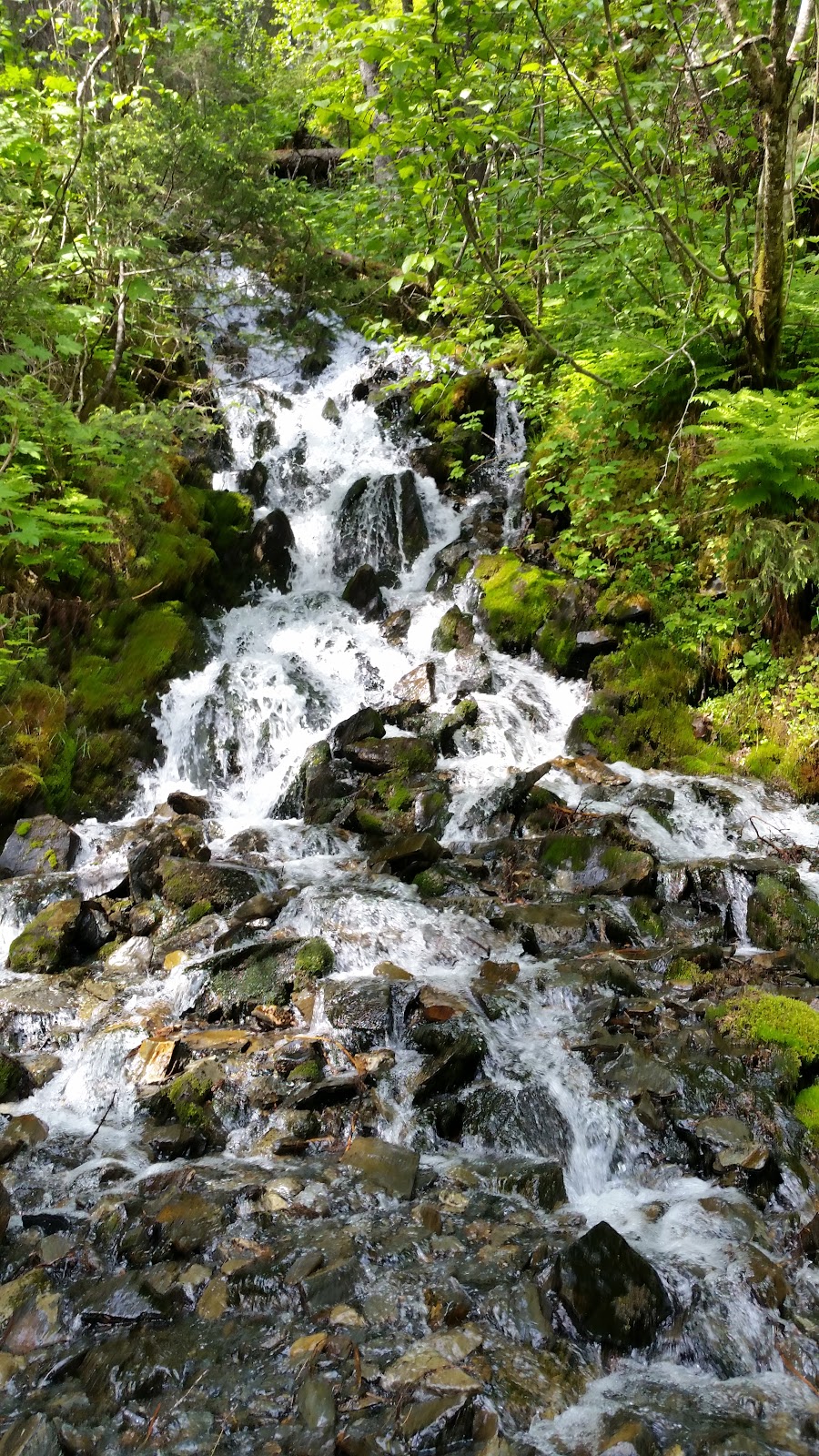
The Solomon Lake trail is entirely on a maintenance owned by the nearby hydroelectric company and isn't all that scenic until one gets to the lake. Small water falls and fern-covered hillsides make up the scenery until one gets to the lake. The lake water was calm. We were the only ones at the lake. I was cautious of bears since the town has the Bear Aware signs posted everywhere. I spotted two mother ptarmigans with chicks on my walk to the lake. One chick chirped in fear near me. It had gotten caught in a crevice on the wooden bridge but was hidden from view. It let me free it. It was lucky it didn't fall to its death below!


It was foggy so the peaks were all shrouded and the view back to the lake was minimal. On a clear day this would have been an easy hike. I timed it at 1:40 hours and 3.8 miles. It was beginning to rain again as I drove back into town. At least we got to do one hike without the rain!


But I wasn't ready to call it quits with the hikes. There was still the Shoud Bay trail on the north side, at the end of Egan street. The trail head here is well marked. Several cars were already parked here but I waited until 3:30pm to begin this hike. It's a long 10-mile hike divided into two sections, the first one ending at Gold Creek, the second one ending in the bay. I went for the first section and figured I'd go as long as I could before turning around. Sadie didn't look thrilled with going out in the rain again so I watched her. Zeke, as usual, didn't care.


The trail starts out flat and goes through a marsh near the bay. The trail is single track, compact dirt but today's rain quickly turned this trail into a quagmire in parts as mud began to form in the deep parts. The trail then ascends at the .75-mile mark, but rather than switchbacking up the hill, it just gently ascends as the trail moves south along the ridgeline, never losing view of the sound. I walked across a marshland studded with wild irises, to a rain forest hugging the hillside. This would have been a beautiful hike in warm weather and clear skies, but the grasses along the trail wetted my pants and both my shoes and socks were drenched when we turned around at the 2.6-mile mark (turn around was at the 3.25-mile mark). I had to turn here because that last steep descent to Gold Creek would have been treacherous climbing back up in this constant rain and I had the dogs and myself to worry about now.


We got back to the van just after 6pm. I had to change my entire wardrobe as everything was wet and muddy. Fog was again lowering for the day. Weather like this can truly dampen one's spirit; no pun intended. The dogs lay in the back of the van, patiently waiting for dinner.
I will be leaving Valdez in the morning, stopping at the Worthington Glacier on the way out and, weather permitting, exploring the St Elias National Park and Preserve with its views of the northern Canadian Rockies. The Kluane Preserve is on the Canadian side. I only have a few more days to experience Alaska.
I need to start planning my return drive on the Alcan by July 1st. I need to relieve Kevin of fire guard as Arizona is burning up with wildfires all across the state. Our monsoon can't start soon enough.
I walked around and hiked for a total of 11.2 miles, with the dogs with me for all but 1.5 miles of it. My daily driving mileage was under 34 miles.
I drove to town to let the dogs walk around the .3-mile overlook trail that starts at the convention center. Nice views of town and the harbor can be seen from here. Then I walked on around the small boat harbor and walked around while I kept the dogs in the van. People were just now starting to walk around. Several ships captain were longing for business.

I logged in 1.6-miles around the small town, finding a decent coffee shop with the Latte Duh before heading out across the bay for the Solomon Lake trail, with a brief stop at the fish hatchery and Solomon Gulch. Here is where the March 1964 earthquake, still the strongest earthquake in US history, took its worst toll. The old town site was completely destroyed. Anyone wanting to stay in Valdez was encouraged to move five miles down the sound to the town's current location.

This side of the bay, with the hydroelectric plant and fish hatchery is a more remote part of the bay, with a view back at the sound and Valdez. The trail to the lake is another half mile on Dayville road, just before it ends for public use and the secure oil storage tanks come into view. I spotted a juvenile eagle in a tree before it, too, flew off.


The Solomon Lake trail is entirely on a maintenance owned by the nearby hydroelectric company and isn't all that scenic until one gets to the lake. Small water falls and fern-covered hillsides make up the scenery until one gets to the lake. The lake water was calm. We were the only ones at the lake. I was cautious of bears since the town has the Bear Aware signs posted everywhere. I spotted two mother ptarmigans with chicks on my walk to the lake. One chick chirped in fear near me. It had gotten caught in a crevice on the wooden bridge but was hidden from view. It let me free it. It was lucky it didn't fall to its death below!


It was foggy so the peaks were all shrouded and the view back to the lake was minimal. On a clear day this would have been an easy hike. I timed it at 1:40 hours and 3.8 miles. It was beginning to rain again as I drove back into town. At least we got to do one hike without the rain!


But I wasn't ready to call it quits with the hikes. There was still the Shoud Bay trail on the north side, at the end of Egan street. The trail head here is well marked. Several cars were already parked here but I waited until 3:30pm to begin this hike. It's a long 10-mile hike divided into two sections, the first one ending at Gold Creek, the second one ending in the bay. I went for the first section and figured I'd go as long as I could before turning around. Sadie didn't look thrilled with going out in the rain again so I watched her. Zeke, as usual, didn't care.


The trail starts out flat and goes through a marsh near the bay. The trail is single track, compact dirt but today's rain quickly turned this trail into a quagmire in parts as mud began to form in the deep parts. The trail then ascends at the .75-mile mark, but rather than switchbacking up the hill, it just gently ascends as the trail moves south along the ridgeline, never losing view of the sound. I walked across a marshland studded with wild irises, to a rain forest hugging the hillside. This would have been a beautiful hike in warm weather and clear skies, but the grasses along the trail wetted my pants and both my shoes and socks were drenched when we turned around at the 2.6-mile mark (turn around was at the 3.25-mile mark). I had to turn here because that last steep descent to Gold Creek would have been treacherous climbing back up in this constant rain and I had the dogs and myself to worry about now.


We got back to the van just after 6pm. I had to change my entire wardrobe as everything was wet and muddy. Fog was again lowering for the day. Weather like this can truly dampen one's spirit; no pun intended. The dogs lay in the back of the van, patiently waiting for dinner.
I will be leaving Valdez in the morning, stopping at the Worthington Glacier on the way out and, weather permitting, exploring the St Elias National Park and Preserve with its views of the northern Canadian Rockies. The Kluane Preserve is on the Canadian side. I only have a few more days to experience Alaska.
I need to start planning my return drive on the Alcan by July 1st. I need to relieve Kevin of fire guard as Arizona is burning up with wildfires all across the state. Our monsoon can't start soon enough.
I walked around and hiked for a total of 11.2 miles, with the dogs with me for all but 1.5 miles of it. My daily driving mileage was under 34 miles.
Monday, June 26, 2017
Day 23 Onward to Valdez
It was time to part from Nina and give her personal time with her other friends Dwayne and Karin. I was up early but didn't shower until 7:30 and didn't leave the yard until 9:15am! So much for an early departure for a long drive to Valdez. I will see Nina again in August as they are expected to be back in town that first week. That's when school starts up for me as well and my summer is over.
And of course I had to stop at the Three Bears Alaska store in Knik, a combination sporting goods and grocery AND growler bar. The manager of the liquor section hales from North Carolina and has been up here for seven years; her husband 11 years, but they had to take a break so that she could care for her husband's ailing mother. Why are women always expected to be the caregivers for the in-laws? I picked up some reduced pre-made meals and headed on out to Palmer for a tasty hazelnut-flavored cappuccino. I finally drove off from Palmer at noon as the cottonwood seeds were snowing down around me.
I was now driving north on the Glenn Highway, the same route I first drove when driving into Alaska. The highway climbed uphill and then down into Caribou Creek, the first place I stopped to walk the dogs two weeks ago. Then the route climbed up again and then down into the Matanuska river valley and its glacier. It's here at the overview where I stopped to walk the dogs for the first time, taking them on the 1.6-mile walk along the ridge overlooking the glacier. The glacier is accessible, just not from this overlook. I was fine with that, as I had a long day of driving ahead of me. I took this walk slowly, reading all the informational signs about glaciers. This was my last chance to walk before undertaking the long drive to Valdez.
I could have stopped at any of the many lake access trails, but these trails are meant for boats and canoes. There are many small lakes and ponds along the highway, but at the 140 mile mark the land flattens and is covered with scraggly black spruce trees that barely look alive. The road also became frostheaved so I had to slow down to prevent the dogs from going airborne again. How to large trucks and RVs drive on this road?
I past through the small town of Glennallen, a small community ideal for campers and people wanting to take a break from driving. I still had over 150 miles to go to Valdez and was fighting highway hypnosis.
That all changed once I was on the Richardson highway (Alaska 4) heading toward Valdez. I could see the Canadian Rockies to the west and the towering glaciers to my south. This road is also badly frost heaved, and the highway department is trying to improve the road: just north of Worthington Glacier and south for nine miles there is construction to improve the highway. I was stopped for 20 miles near the pass with some of the most spectacular scenery around me. Nevermind that there were signs indicating AVALANCHE DANGER, driving this road with 40 miles to go felt more like a Norwegian fjord: steep lush mountainsides divided by a narrow canyon. I was in Keystone canyon, the same name as the infamous Keystone pipeline.
Worthington Glacier is near the top of the pass, with the state park on the south side with a trail to the top. I will do that tomorrow, weather permitting, as it began to rain hard when I got to the pass. The rain never relented. It was 6:30pm, I was looking forward to a walk, and it was raining. Just my luck again.
The town of Valdez doesn't have much. It's not as touristy as Seward since the oil industry provides the economy. Storage tanks dot the northern edges of town. I found the Shoud Bay trail head right away but didn't hike it due to the rain. Instead I took the dogs on a short 1.4-mile walk to the bay off Homestead Road where I could see tidal waters pushing against river water. Clouds shrouded the peaks around me. I was standing on the shaly banks of Prince William Sound, once a place of a horrific oil spill caused by the oil tanker Exxon Valdez on March 24, 1989. The oil company got off on the environmental damage the 10.8 million gallons of spilled oil it caused, which is why I've boycotted buying gasoline from Exxon ever since. But like that matters. BP has dumped benzene into Lake Michigan, often at toxic levels, and is still making a profit.

I stood on the shore and looked around, gasping at the beauty around me. Steep mountain sides jut right into the bay, with waterfalls gushing from every angle. The terrain looks like a Norwegian fjord. This area should have been a national park or at least a wilderness sanctuary. Instead it's dominated by oil tanks and tankers and oil trucks coming and going into town. If it hadn't been raining I would have hiked a bit of the Shoud trail. I will try that trail in the morning. Hopefully it won't be raining then.

I drove around the small town. The harbor is for small boats only and a few shops edge on the pier. RV parks crowd the northern entrance into town. I found the Safeway and got the dogs and me a dark chicken meat platter on sale. We finished that off while still in the parking lot. A group of teens were speaking Arabic outside the Oaken Keg (liquor store off the grocery store). The rain finally stopped at 11pm.
Sunday, June 25, 2017
Day 22 West Butte and the Matanuska river
I spent the morning waiting. It was partially my fault since I should have just taken the initiative. I was up at 5:45am but didn't want to wake up the others and waited for everyone to shower first before they headed out to church with Nina and Mark. However, none of them wanted to go to church. They were all tired and Dwayne said this was his Father's Day weekend he wanted to enjoy doing things with his sons since his son Brett was visiting from Seattle. I chatted with Karin when I should have just gone to the trail head and met with Nina later. I did the better thing in the end and waited for Nina to be done with her church potluck and hiked up West Butte with her. The trail head parking lot is only six miles from their potluck location at Matanuska River park.
West Butte is a busy trail as it's only 1.3 miles to the peak and close to town. It's also a very popular trail with hikers of all abilities trekking up the steep grade and 505 stairs. The view from the 840' peak, however, is worth it. We shared the view with at least 50 other hikers, eight dogs (of which four were GSDs) and several babies in backpacks or shoulderbags. Pioneer Peak at 6398' is the tallest peak nearby and across the wide river valley. What a view. We were on the peak longer than planned but why rush? Zeke was curious about the drone flying overhead but Sadie just wanted a shady spot.
The hike was three miles round trip. We stopped at the river bridge for another mile along the rushing river. This is another popular spot for the locals to run their dogs or wade in the cold mud. We didn't cross the water to get to the plains, but the dogs enjoyed the cool river before we headed back to Knik in the late afternoon. The others hadn't come back yet from their hike in the Ekutna state park.
More later
Saturday, June 24, 2017
Day 21 Talkeetna
Today's easy day trip was to Talkeetna, the gateway to Denali. I had heard good things about that tourist town. It had been a while since Nina was there. The mayor of the town is an aging orange tabby cat named Stubbs.
It was my first sunny day in Alaska. By the time we were on the road to Talkeetna, 80 miles away, it was 72F outside. This was my first day not wearing that yellow raincoat. The warmth felt good. We drove in a northeasterly direction on a stretch of highway that saw a devastating wildfire wipe out the forest. Dead trees still line the highway north of Willow.
More later
Friday, June 23, 2017
Day 20: Elmendorf AFB, Flattop, Moose's Tooth pizzaria in Anchorage
I am not sure of where I was parked on base. I thought it was the guest lodge but there were airmen walking nearby. It was 7am before I even made it to the gym to shower. A poster advertising a Gay Pride even on the base surprised me, as being openly gay while I was in the army was reason enough to be discharged. I'm glad the military is now more humane toward more diverse people.
The sky still looked foggy from the peaks, so once again I was easily distracted when I saw the Eagle Glen fitness park near the base entrance off Park Avenue. I stopped there to walk the 3.2 fitness trail behind another dog walker. We were the only ones using this seasonal park as the park headquarters looked permanently closed and the area didn't look maintained. Signs warning not to feed the fox were posted, as well as reminding walkers to report all bear sightings. I did see a red fox pop its head out of the woods, but then quickly disappeared back into the hemlock-spruce forest.
The fitness park must be used primarily for winter sports. Trails are either mowed across the grassy field or covered in crushed granite for the walkers. I let the dogs despite orders by the base commander to keep dogs leashed at all times. The dogs were so well behaved. The most they did was run through the fields of dandilion seedheads. Zeke chased after a squirrel who ran up a tree. That's the most unruly behavior they displayed. I racked up 4.8 miles when I was done. A stop at the BX for some souvernirs took 1.5 hours but by then I was ready to tackle Flattop peak, despite the nearby peaks being shrouded in fog.
I didn't even get started with the hike until after 3pm. Where did the time go?
More later
Thursday, June 22, 2017
Day 19 Soldatna to Anchorage
Today the intent is to drive back toward Anchorage and make it to the air base there for a shower. Let's see if that happens. I easily get sidetracked by stuff off the beaten path.
I was slow leaving Soldatna. I had my coffee at McDs and then walked along the creek trail. The boardwalk is metal and the dogs weren't liking it, so I took them back to the van to finish this walk. There were other older people out walking the trail.
I took it slowly today, stopping at historical places while driving east. A mother moose and her two calves caused a bit of a pile-up near town.
My one surprise was stopping in Hope and walking the cliffs above the mudflats. We only walked near the rock, as the mud can suck you down. There was an eagle pair near the old town. I talked to an older volunteer musuem volunteer from New York who was eager to tell me the history of the place. I parked at an undeveloped campsite for a few hours before continuing toward Anchorage.
Stopped to get some real glacier water off a spring coming out of the rock. It's a popular stop for locals to harvest drinking water.
Made it to Anchorage by 9pm, parked off 4th street and tried the 49th State Brew pub before going to Elmendorf AFB for the night.
Tomorrow: Flattop Mountain in the morning.
(This is an abridged journal; too tired to write more)
Wednesday, June 21, 2017
Day 18: Homer to Soldatna
I was up again by 3:30am, still sitting up in the driver's seat. I could see low tide now, and a wide, cleanly-swept beach was exposed. Several dog walkers drove up in the early hours to walk their dogs in the low-tide beach, so I did the same at 7am, when the sun had warmed up my body enough to venture out. I started on the bay and then moved to the Beluga Slough, then back to the bay. Moose tracks were around the slough and several bald eagles sauntered the fresh beach. Sadie and Zeke played in the sand, whose waters will wipe the beach clean of their tracks with the next tide. We had walked 2.17 miles for the morning.
I was hungry and stopped at the nearby Two Sisters coffee and bakery. The coffee and cheesecake I ordered were quite tasty, and the perpetual line of customers tells me this is a busy and popular place. One thing I did note, though: all electric plugs are sealed shut in the customer dining area. Apparently moochers like me who like to plug in a laptop for a free recharge while in the store are discouraged from lingering in the shop long after the coffee and cake are gone. At least it offers free open wifi.
There really isn't much to Homer besides the view of the fjords from the Spit. You can't stop on the Spit and park and walk around without paying for parking, which is strictly watched with yellow wearing parking nannies. This is a fishing-RV-touristy town with a very small historic district. Lots of people live off the grid here. I noticed this all along the highway to Homer.
I drove back north on the highway I took into Homer. Skies were clearer today and ten miles out of town I could see the snow-capped mountains across the Cook inlet. I stopped again at the Russian Orthodox church in Ninilchik but this time spent time with family living off the grid here. The kids were selling fudge and sodas and I bought some in exchange with chatting and taking their photos. The nine-year-old is smarter than his years but doesn't seem happy having to live in the conditions he lives in: the family has two old trailers as their home. They use solar and wind power, get their water from a nearby creek, harvest some wild plants. Dillon, their father, showed me how the starchy roots of a chocolate lilly can be boiled and eaten like rice. The fudge was also quite good.
I did more historical exploring and chatting today than hiking. I stopped at the historical site in Kassilof, walked around the rebuilt cabins of the first homesteaders and then made it back to old Kenai. This time I ate lunch at the Burger Bus where I had the cheapest burger yet on the Kenai. The owners were also very friendly and happy to serve me. From there I stopped at the Kassik brewery outside Nisilki, a small tasting room where I tried all eight beers in 2-ounce glasses and chatted with the owners and a young man, Peter, who said I sat next to him last night at the St Elias brewpub but we didn't talk. Now today we chatted up a storm. He lives in San Antonio but works for Tesoro, a big refiner in Alaska. He was up here for business and had to fly out at 7pm for the redeye flight back down to Texas. Like me, he likes to taste microbrews. Two other men, Kevin and Marty from Eugene, were curious how it was for me to travel so long alone. I never really thought of the I dangers since I am aware of them and act accordingly. One thing I don't do alone here is hike, because of the bears, and instead do town pathways for exercise.
The couple running the Kassik brewery, Debbie and Frank, are from the Redding, CA area. Both started the company out of their home brewing hobby; neither one is a master brewer. But the beers I tasted were all very good. Frank, however, is now 60 years old and tired of the task. He doesn't see himself brewing more than five years more. Their son Jason helped for a while but has since left Alaska for warmer pastures. The brewery is nestled in the spruce trees outside of town, with limited hours (closing at 7pm) They have won several awards for their Scotch Ale and sell in Washington state.
The tasting room got crowded just before I left. Peter took off for the airport and I said my goodbyes to the owners and Kevin and Marty. I drove back to Soldatna and parked in the Fred Meyer lot where I called it an early day.
I drove 142.4 miles today, all empty ones since I'm backtracking.
Tuesday, June 20, 2017
Day 17 Onward to Kenai and Homer

I missed Holly's departure but I was up to chat with Doug before he took off for work at 6:30am. Now I was all alone once more. Most of my stuff was already packed from yesterday morning. My suitcase, battery charger, laptop and hygiene kit were all that remained. A light drizzle hid the sun. This is the summer solstice and I plan on spending it in Kenai for tonight. I'll be exploring the highway there. Should be plenty of bald eagles and the salmon should be spawning. I'm not much into salmon, but I might as well see the fish while I'm up here.

I'll be back in Nina's neighborhood by Saturday and we will do Summit Lake then. I finally drove away at 10:13am, after a rainy 2.2-mile loop walk around Vinewood Lane. Zeke didn't mind the drizzle, but Sadie looked tired.

My first place today was visiting Exit Glacier of the Kenai Fjord National Park. The glacier slowly comes into view along the 8.6-mile drive to the visitor's center. Markers depicting the year mark other documented lengths of the glacier that is clearly dwindling in size. I hiked up as far as I could go, taking in the impressive views of this receding glacier. Lots of Japanese tourists were sharing the path with me. If it hadn't been raining, I'd have gone down to the closest point possible, but the wet rocks made that attempt too dangerous. A quick exhibit on black and brown bears by a forest ranger Anne Fineman from Long Island completed my tour. I had spent over two hours at this busy park and I'm glad I got to walk the trail! The 2.6-mile route is just perfect for a leg stretcher.


The rain started letting up early in the afternoon, making my drive north toward Moose Pass easier. I stopped for 40 minutes at the I.R.B.I knife shop (that stands for "I'd Rather Be Independent") and met the jovial knife carver, Virgil Hunter. He carves knives out of high-grade carbon steel and attaches them to moose antler, Alaskan corral or anything else, and custom makes them according to customer's needs. "I don't get paid until I finish a knife" explained Virgil, showing me a $1200 knife and that one wasn't even his most expensive.
Hunter and his father moved up here in the mid 1960s from Idaho and built the log cabin store by hand. Outside he keeps wood carvings from another artist from New Mexico, and three mannequins that pose right off the highway shoulder. It's these mannequins that caught my attention. He showed me his military coin collection, talked about the rock band Aerosmith that stopped by and bought a knife back in the early 1990s, and showed me his old camera collection and police patch collection, mostly donated by customers and passers-by. Hunter was as interesting to talk to as his exhibit store. He and his store are probably in an Alaskan version of Off The Beaten Path roadside attractions.
I slowly made it to Kenai in the late afternoon, crossing a very scenic stretch of the highway going west through Cooper's Landing and Sterling before the landscape flattened out to marshy flats studded with scraggly black spruce. I wanted to see the historic Russian Orthodox church in Kenai, one of the oldest in Alaska. I found it near a bluff overlooking the Cook inlet, with apartments around it. I ended up walking another 2.7 miles with the dogs along the breezy coastline and through a municipal park, up the Meeks trail and back. A yellow warning sign reporting the last bear sighting as June 3 was posted in the park.
I finished off my day at the St. Elias brewpub in Soldatna, 12 miles east of Kenai. The area has everything for the traveler. Even gasoline was cheaper than in Seward: $2.85 to $3.05, with all the fast food franchises. RVs were lined up in the Fred Meyer parking lot but that is not where I wanted to spend the night. With cloudy skies above, I made the decision to drive down to Homer to watch solstice move in. That also was a pretty drive, with another Russian church in Ninilchik overlooking the bay. Clouds hid any sun set (not that I was expecting one) and at 10:30pm as I drove to the Spit and back, I could see plenty of people walking the pathway and diners enjoying a meal. The fjords to the south were visible from this location. The town wasn't bustling now as people were slowly ending their day's activities. The Spit was packed with RVers so I opted to get back on the mainland, parking at Bishop's Beach to watch twilight move in. The sun never did set. There were signs warning against overnight camping, but there were two other vehicles parked near the shore so I joined them. A cop car drove by around midnight but did not stop. Apparently it's an unwritten rule that overnight camping and dog walking are allowed as long as the campers and dogs don't get loud or aggressive.
It was a very peaceful night. The water barely made a sound. It was 50F when I fell asleep in the driver's seat, still in an upright position.
I drove 252.5 miles today, with a total of 4744 miles to date.
Monday, June 19, 2017
Day 16: Seward local hikes

Holly was quietly up and out before I was awake in the upper loft. She was gone by 4:30am and Doug had just left the lodge for his job with the National Park Service at 6:30am when I got up. I was now alone. I let the dogs out to pee (no surprises this morning!), finished the last of the coffee, washed a load and uploaded my blog. I'm still so far behind, especially with adding photographs to my hikes. I finally left the lodge at 10:45am

Holly told me today would be the last of the sunny days. Which hike would I try? Mount Marathon in town sounded interesting. While steep, the loop around is under five miles with views of Resurrection Bay. That was tempting. I wanted to do something short and scenic that wouldn't be too exhausting after yesterday's long hike. This will be my last full day in Seward before I head back north, stop for a few short hikes, return to the Knik area and hike with Nina if she has time, and then head back down the Alcan at the end of the month. I want to see the towns of Kenai and Valdez as well. Rain, however, will return tomorrow for the rest of the week.

Today was a smorgasbord of short local hikes. I started with the Mount Marathon hike. The trail head off Monroe and 2nd Ave was easy to find and I found a spot right across the street to park. It turned out Zeke was getting restless, pacing in the back of the van. He will only do that when he has to go, and go he did, just outside the van and on the edge of someone's garden. It was the same diarrhea from yesterday. Now I know who the culprit was! He didn't show any other issues the rest of the day, so hopefully whatever gave Zeke the squirts is now on the mend.
The trailhead is near the historic southern part of Seward so I decided to walk around here. I even went local and kept my sweater and rain jacket in the van and just wore my red DriWeave shirt. A local bank marquee said it was 59F out; it felt more like 33F!
I also went tourist. I kept the dogs resting in the van while walking along the waterfront, former start of the official Ididarod race. It's a nice little walkway, with historical markers along the way. One could watch whales and otters but today I saw neither; just a lot of annoying seagulls. A tent and RV campground managed by the city of Seward is near the northern end of the park. It's $10 to tent, $20 to dry camp with an RV. It's not a bad deal at all if you can get a spot.

I had a quick lunch at the Thorn's Showcase and Lounge for a quick patty melt and Alaskan Ale. The lounge is also a restaurant that seems to be stuck in the 1970s. It was dark inside and I sat at the bar near the entrance. The place was busy during my stay. The prices were reasonable for what I got in Seward. Seems like you can't get a plain cheeseburger for under $13.


After my walk in town, I drove to Two Lakes park near the base of Mount Marathon to walk the dogs through this small park. The trails all run north-south and aren't marked, but one would have to be completely directionless to get lost here. A homeless man jumped out of the bushes when I parked, ran up to the neighboring picnic area to watch me, and waved. That was a tad creepy. The man was not there 45 minutes later when I got back from the walk. It started drizzling as I drove off, and the mountains around Resurrection Bay were slowly getting shrouded in fog again. Looks like the usual rain is back.

My last walk was around the commercial marina, where fisherman were cutting up their day's catch. Salmon and other ugly fish lay dead in wheelbarrows waiting to get filleted. By now the rain clouds were concealing the mountains. One cool thing I saw was a giant chalkboard with "Before I Die" and people were encouraged to write something down that they still want to do. I wrote "Hike around Alaska." I guess this road trip has fulfilled that dream of mine.


My daily walking mileage came to 5.5 miles. My driving mileage was under 23.6 miles: to and from and around Seward. Grand Total so far is 4491.5 miles.
Sunday, June 18, 2017
Day 15: Seward's Lost Lake trail, (14.5 miles)


The early morning, however, was not a good start. I got to the van at 7:30am to let the dogs out to pee and discovered a massive explosion of diarrhea on my sleeping pads and sleeping bag and part of my pillow. No wonder Sadie jumped out of the van so fast! Luckily the mess was only on my washables and I had a hose outside the lodge to spray the mess off, but had this happened along the remote Alcan, I would have been literally in deep shit. I won't be feeding raw meats to the dogs so late in the day again! They seemed fine once on the trail.


Doug dropped us off at the trail head and we started the hike at 9:18am. There was no one else at this trail head. The more popular route to start at is the southern trail head going north. We were alone and Holly made an effort to clap her hands and chat to warn the bears of our presence. I was tired and still lethargic from having been up late the night before. I blew my whistle a few times. And when at the 4-mile mark I discovered that I had dropped my phone and had to retrack my route for .6 miles, I knew my fatigue was making me do errors I wouldn't normally do. I was up late the night before trying to update this blog and now I was paying a price.

The trail slowly ascends through a spruce forest. Open views north expose Kenai lake. An old ski lodge is off the trail three miles into the hike, but the alpine views don't come until around the fifth mile as the glaciers approach and the trail follows a fairly level ridgeline. Approaching Lost Lake from the north like we did is longer, but the ascent is not as steep as from the southern terminus. Holly hadn't hiked the trail from this approach and got to enjoy the views for the first time just like I did. The ridgeline was like hiking the John Muir trail all over again, except that trail lingers more at the 10,000' and not 2000'.

The NO CAMPFIRE rule goes into effect at around 2000, or at the 5th mile. That is when the trail going south approaches the ridgeline and the timberline ends. This alpine elevation continues until the 11th mile. We crossed several snow patches and a bridge over a creek (which Zeke insisted on fording rather than using the foot bridge)

We ate a snack at the 7th mile facing Lost Lake. The dogs each got a pouch of wet food and rested. Once I rested with some trail mix and an apple, I felt more energized. We had a final ascent to the highest peak at 2240' and it was all downhill from there. Most of the people we met were now coming up from the south, both mountain bikers and hikers. Many of the local men were shirtless despite the 55F. Some of the fitter women were wearing tank tops and running gear, And here I was keeping warm in two layers of DriWeave and a winter rain coat!

Seward and Resurrection Bay are visible from the high peak. Seward is not a big town and its small size is even minimized from this view. But what a view this is! We were now slowly reentering the rain forest and nearing the southern trail head. The hike took us 6:20 hours. At 3:38pm we were at the southern parking lot and Doug came within a few minutes later to pick us up. It's only a few minutes from their lodge. In my final fatigue I had left my cellphone camera on the bench while waiting for our ride, and that camera was still there 4.5 hours later when I came back to retrieve it!

This hike is highly recommended for those visitors who want to experience Alaska's southern coast. I am so grateful I had a willing, patient guide like Holly showing me the local beauty.
I knew the dogs were as tired as I was. I gave them water and they rested the rest of the day in the van with no other explosive surprises. I ate my breakfast burrito that I had purchased in Knik on the drive down, had a few local beers from my 12-pack and called it a day. Both Dough and Holly go back to work tomorrow and I will be on my own for the day.


The big kicker today was learning from Doug after the hike and on our short drive home that a home owner at the northern trailhead had stopped Doug as he was driving away to warn him of two grizzlies that were in his yard that showed no fear of humans. They were near the trail when we started. That now explains Zeke's stance at the start when he stopped in front of me to smell the air. He probably got a scent of the bears. He never chased or ran around me like he normally does at the start of any hike. Both dogs stayed close by the entire time. We did spot some scat near the start, too, a dark brown furless pile that we wondered was grizzly scat. It was still soft to the touch. As Holly said, ignorance is bliss. Had we known at the start that two bears were nearby, we probably would have hiked in a more panicked mode. Why ruin a good thing?

http://www.mapmyhike.com/workout/2271734108
Miles driven today (to and from trailhead looking for lost phone) 18.
Subscribe to:
Posts (Atom)