High winds that began yesterday evening continued into the night and this morning. It was our first late autumn winds that helped blow away many of the colorful leaves. Rain began before sunrise which kept me from walking the dogs before heading to school. The peaks were shrouded in thick clouds on my way to school, and by noon I could tell that there was snow above 7000'.
Then, during my lunch hour, I read about a 6.7 earthquake just north of Anchorage, which was upgraded to 7.1 an hour later. I immediately thought of HollyO in Seward and a few other friends I have in Alaska. Holly reported back a few hours later saying that they are ok, no damage to their rental home, but a tsumani warning was issued and she had to seek shelter with her husband Doug at his office. The tsunami warning was later cancelled and both were able to go home. Holly was at work and they spent some time reshelving the store and picking up merchandise that had fallen on the floor. The Glenn Highway, a beautiful road that starts in Glennallen and travels along the Matanuska River to Palmer, suffered serious damage in sections. This will take some time to repair, so people who live off that road will suffer the most until the road is fixed. Good luck with that, as there's plenty of snow there now. No deaths were reported, but more aftershocks are expected.
https://www.adn.com/alaska-news/2018/12/02/the-70-quake-felt-differently-across-anchorage-could-release-more-big-jolts/
I promised the dogs I'd walk them when I got home, and I did. It was noticeably colder today over yesterday, but this is the kind of weather that Minnie likes! While she still is the slowest dog in the pack, she pants less when it's cold out. I bundled up for the walk, wearing both a quilted jacket as well as a down vest. We managed 3.2 miles.
A military convoy with APCs and empty spools of wire rode back into town as I drove the dogs home after dark. (No news of caravan travellers from central America breaching the border in our area.)
Late in the evening I read on CNN that President George HW Bush had died at age 94. The media gave no clue that he was near death like it did for Barbara Bush when she died April 17th of this year (aged 93), and no cause of death was given. While I did not always agree with the president, he was always an honorable man, a good man, and a devoted husband and father. What better legacy to leave behind?
It was a busy day for news!
Friday, November 30, 2018
Wednesday, November 28, 2018
Lower Miller Canyon

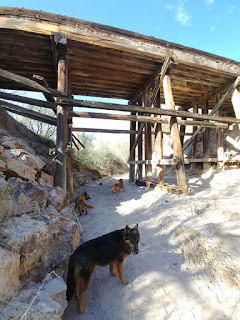
Lower Miller Canyon is that three miles of trail beginning at the Perimeter trail parking area and going uphill to the Miller Canyon trail higher up the road (by the Beatty bed and breakfast). This area was heavily damaged in the 2011 fire and flood. Many mature trees were burned and then toppled that summer. The creek suffered massive rockslides. The 1.5 mile of creek trail was rerouted and in parts recreated with help of the forest service. Before the fire and flood, it was a lovely three-mile out-and-back trail popular with BnB guests, equestrians and local dog walkers.

Sycamores and Arizona ash grow along this creek and are now almost past their prime. Since I didn't work today I opted to take all four dogs down to the creek for a quick creekside walk. If too many people were there, I'd just go in the opposite direction. As it turned out, there was no one in the lower parking lot so off we went, following the creek uphill.

And what a colorful walk it was! The sun was high enough to shine through the leaves and emphasize the colors. The dogs were of course oblivious to the autumn display and were more interested in splashing around. No one was on the trail, either, so we had the entire creek to ourselves.

The entire walk took me no more than 90 minutes. I walked slowly so that they could enjoy the walk. I took photographs and stopped a few times by the creek to let Minnie dive in.

It was in the mid 60s, wonderful hiking weather with water nearby, but a cold front is coming that will lower temperatures for the coming week and bring more seasonal weather with it.

Tuesday, November 27, 2018
Tinker Pond/Sheelite Loop
This entire hike is on Fort Huachuca. Non-military personnel would need an access pass to hike this. Follow signs to Garden Canyon, then turn left at the first Y to the aerostat, then a second right toward the Tinker Pond Navigation site. Park in the large gravel parking lot. One can hike here as long as no military exercises are going on. The trail starts across from the parking lot and is flat the first half mile, before climbing in elevation the rest of the way.

I had done this hike twice before in early 2017. While all of it is on wide fire breaks and steep with loose rock, it does provide scenery and remoteness. I've never come across anyone in this corner of the post. I began it today after noon, knowing that both I and the dogs needed the exercise. All four dogs were with me.

The grass has grown back nicely since the controlled burn from 18 months ago. There is no sign a fire was here unless one looks closely at the base of yuccas and some of the oaks. Everything blends back in.

The dogs frolicked on ahead, while Minnie panted the entire way behind me. We rested several times under the shade of mature oaks, and when we reached Tinker Pond at the two-mile mark, I let the dogs rest in the murky waters to cool off. It had been a while since the pond was replenished with rain water, but there was enough there to cool off in. When the dogs were ready to hike some more, I continued uphill. Here is where the trail gets steep and the terrain loose.

I took the left trail going up hill from the pond. This trail meets at the boundary line with the National Forest and Brown Canyon. The grade was too steep for comfort, and all I saw looking ahead of me was more steep grade. This part wasn't very pleasant at all. I opted to turn around and walk southeast along the Sheelite ridge, with views toward the Brown Canyon ranch house and the San Pedro Valley, separating the military post with the national forest. There are two steep hills going in this direction, but at least I was going back toward the car. The oak-studded hillsides revealed lone-standing ash trees when one looked carefully.
I turned off the boundary/jeep road to head northeast and downhill toward the water tank with "Site Boston" on it, where a Gobbler Guzzler is. I let the dogs drink from this water before resuming the walk back to the Honda, a flat half-mile. It was a pleasant 5.5-mile hike for the solitude and views, but due to the steepness, not a hike that many would enjoy.
Saturday, November 24, 2018
Mural Hill in Bisbee (6502')
I first did Mural Hill on March 20, 2017 and really enjoyed this hike. It's an unmarked trail going up to a prominent hill in the Mule Mountains that overlooks the hidden strip mine of Bisbee. One can't see this new mine from the public roads as one drives into town from the east end, but one can see all that digging from above.
I had suggested this hike to my hiking friends as a post-Thanksgiving Day hike, one that offers some remoteness and gives one a physical challenge. HollyW and SusanM both agreed to hike with me. I took Sadie and Zeke. We met in front of the Old Bisbee Brewing company, climbed up the pedestrian stairs to the north of the building, and continued our walk on OK street hiking northwest to the end of the street. Unmarked trails into the nearby hills are accessible here.

It had been a while since I was in Bisbee. I always enjoy having an excuse to come to this quirky town, but had it really been months since my last visit? The trail starts at the end of OK Street and meanders around that first hill, Youngblood Hill. A statue of Jesus now marks the way with "To My Cross," standing right in front of the "World's Largest Chicken Coop." As I said, this town is quirky.
 This first section around the hill follows the same trail as the one going up to the shrines above. The Shrine Hike is a unique walk in itself, and one can see at least five different shrines around the hill, with new locations always popping up. I got slightly disoriented the here, taking the wrong trail right and finding us going uphill when we should be going down into the first gully. We had to retrace our steps to the first trail and then take the second left. This trail goes between the two hills while the main trail then goes toward Zacatecas Canyon.

Once we were on "the" trail to Mural Hill, I had no other orientation issues. The trail is heavily overgrown in parts that required me to stop and access which direction to take. The pink markers from last year are gone or faded, but I did find newer yellow markers in the last mile. We went up and over two gullies, past a small cement dam and then a gabion dam (rocks held together by strong metal mesh), then hiked up a side of a hill to get on the mining trail that takes us to Mural Hill.

The views along the way are breathtaking. Both Holly and Susan had never been here before, and we stopped a few times for them to take in the views of Warren, the Sonoran mountains in the horizon, and other canyons visible from the ridgeline. Any wildflowers that bloomed here during the monsoon are long gone. Last time I had the blooming pink catclaw, this time it was just the many overgrown shrubs along the trail that would poke at us and rip at our clothing and caps. I had warned the gals to wear thick shirts and pants for this hike, and they thanked me for this. Our hands got scratched up just holding the thorny branches away from our faces as we'd hike under the tall growth. I said my share of expletives.


One can see where the old mining road snakes up the sides of the hills toward Mural Hill. The reef is rather prominent and can be used as a landmark. The white cross on Youngblood hill is also very prominent.
I lost battery power at the 2.31-mile mark, with a mile to go to the top. Holly and Susan were great hikers and followed me, but we also took time to photograph the views. I had to give the dogs water because despite the forecasted 63F for today's high, there was plenty of sun shining on them. Both dogs were super troopers.

The last time up Mural Hill, I followed the track that the Huachuca Hiking Club had created, cutting up a steep side of a hill. This time we followed the trail, which now goes around Mural Hill to the north and begins a descent. I led the gals up a steep drainage going uphill, with natural rock steps and lichen-covered chapparal to hold on to. It turns out that the real trail continues just past that drainage, dip down a bit and then climbs up the reef to the top. Someone had marked the trail in yellow hunter's tape. We made sure we went down this way on our descent.

Both gals gasped in awe of the view once we made it to the summit. The wind was noticeable now and we didn't stay long. We ate our snacks and chatted. The old chicken burrito I had for the dogs had gotten too moldy and I threw it over the cliff, but didn't throw it far enough. The burrito had gotten lodged in the branches of a small shrub dangling precariously over the cliff. Sadie was determined to get to that chicken, much to my chagrin. Only a leash kept her safe now. Zeke stayed by my side and was content with the small snack pack I had for each dog: a 2.6-ounce tub of high-end dog food, turkey variety.


There are other trails on the lower hills to the north of Mural Hill that are tempting for me to explore. Susan seems interested in exploring with me. I'd like to come here after a fresh snowfall. We saw no one on the trail except for a young couple heading up to the shrines.
The northern slopes of the hills around us were baren of any hillside trees or shrubs. Had there been a fire that wiped out the foliage? It sure would be a hot hike here in the summer, with no shade trees along the way.
The return hike was the same route in reverse. We stopped once for a water break but made the return at a steady pace, getting back to our cars at 1:45pm. The parking lot in Brewery Gulch in front of the brewery was now packed, and our parking spots covered real estate. Since it was Susan's birthday, we all agreed to have a late lunch at the Bisbee Breakfast Club (BBC), a nice breakfast-lunch diner open 7am-3pm seven days a week. It's off the tourist route but still very popular once the tourists hear about it, and parking is ample. I parked the dogs in deep shade and went inside to eat.
I had suggested this hike to my hiking friends as a post-Thanksgiving Day hike, one that offers some remoteness and gives one a physical challenge. HollyW and SusanM both agreed to hike with me. I took Sadie and Zeke. We met in front of the Old Bisbee Brewing company, climbed up the pedestrian stairs to the north of the building, and continued our walk on OK street hiking northwest to the end of the street. Unmarked trails into the nearby hills are accessible here.

It had been a while since I was in Bisbee. I always enjoy having an excuse to come to this quirky town, but had it really been months since my last visit? The trail starts at the end of OK Street and meanders around that first hill, Youngblood Hill. A statue of Jesus now marks the way with "To My Cross," standing right in front of the "World's Largest Chicken Coop." As I said, this town is quirky.


Once we were on "the" trail to Mural Hill, I had no other orientation issues. The trail is heavily overgrown in parts that required me to stop and access which direction to take. The pink markers from last year are gone or faded, but I did find newer yellow markers in the last mile. We went up and over two gullies, past a small cement dam and then a gabion dam (rocks held together by strong metal mesh), then hiked up a side of a hill to get on the mining trail that takes us to Mural Hill.

The views along the way are breathtaking. Both Holly and Susan had never been here before, and we stopped a few times for them to take in the views of Warren, the Sonoran mountains in the horizon, and other canyons visible from the ridgeline. Any wildflowers that bloomed here during the monsoon are long gone. Last time I had the blooming pink catclaw, this time it was just the many overgrown shrubs along the trail that would poke at us and rip at our clothing and caps. I had warned the gals to wear thick shirts and pants for this hike, and they thanked me for this. Our hands got scratched up just holding the thorny branches away from our faces as we'd hike under the tall growth. I said my share of expletives.


One can see where the old mining road snakes up the sides of the hills toward Mural Hill. The reef is rather prominent and can be used as a landmark. The white cross on Youngblood hill is also very prominent.
I lost battery power at the 2.31-mile mark, with a mile to go to the top. Holly and Susan were great hikers and followed me, but we also took time to photograph the views. I had to give the dogs water because despite the forecasted 63F for today's high, there was plenty of sun shining on them. Both dogs were super troopers.

The last time up Mural Hill, I followed the track that the Huachuca Hiking Club had created, cutting up a steep side of a hill. This time we followed the trail, which now goes around Mural Hill to the north and begins a descent. I led the gals up a steep drainage going uphill, with natural rock steps and lichen-covered chapparal to hold on to. It turns out that the real trail continues just past that drainage, dip down a bit and then climbs up the reef to the top. Someone had marked the trail in yellow hunter's tape. We made sure we went down this way on our descent.

Both gals gasped in awe of the view once we made it to the summit. The wind was noticeable now and we didn't stay long. We ate our snacks and chatted. The old chicken burrito I had for the dogs had gotten too moldy and I threw it over the cliff, but didn't throw it far enough. The burrito had gotten lodged in the branches of a small shrub dangling precariously over the cliff. Sadie was determined to get to that chicken, much to my chagrin. Only a leash kept her safe now. Zeke stayed by my side and was content with the small snack pack I had for each dog: a 2.6-ounce tub of high-end dog food, turkey variety.


There are other trails on the lower hills to the north of Mural Hill that are tempting for me to explore. Susan seems interested in exploring with me. I'd like to come here after a fresh snowfall. We saw no one on the trail except for a young couple heading up to the shrines.
The northern slopes of the hills around us were baren of any hillside trees or shrubs. Had there been a fire that wiped out the foliage? It sure would be a hot hike here in the summer, with no shade trees along the way.
The return hike was the same route in reverse. We stopped once for a water break but made the return at a steady pace, getting back to our cars at 1:45pm. The parking lot in Brewery Gulch in front of the brewery was now packed, and our parking spots covered real estate. Since it was Susan's birthday, we all agreed to have a late lunch at the Bisbee Breakfast Club (BBC), a nice breakfast-lunch diner open 7am-3pm seven days a week. It's off the tourist route but still very popular once the tourists hear about it, and parking is ample. I parked the dogs in deep shade and went inside to eat.
Friday, November 23, 2018
Contention City (Ghost Town)
Hike: 7 miles o/b
Elevation 3900'-3600'
Trailhead is on In Balance Ranch Road, turning north at MM60 off SR82. Park in trailhead parking lot for Santa Cruz de Terrenate. The first .7 miles are the same.
Trail is partly an old railroad bed
Contention City, or simply just Contention, is now a ghost town along the San Pedro River, just a little over a mile north of the old presidio. Calling it a ghost town is perhaps exaggeration, as there is very little left of this site, a mill town that flourished in the early 1880s but which quickly died when mines in Tombstone flooded later that same decade. Floods have taken away the rest.
I got to the Santa Cruz de Terrenate parking area and began this hike at 1:34. It's a late start for sure, especially since the sun sets shortly after 5pm now. All three dogs were in fine form, even Minnie, who was happy to be outside. It was only 63F and I realized at the start that I had left my Camelbak in the Escape! At least the dogs would have water once we got to the river.
I tried to keep the mileage in my head: at .71 miles I reached the first bridge. I took a left here, and hiked another half-mile. At the 1.26 mile I took a right and continued on downhill toward the river on a wide maintenance road. Cottonwoods are still displaying their yellow leaves. I could see the old Contention mill in the side of the cliff as I got close to the river, but getting to that cliff was harder than I thought. At 1.86 miles the road crossed the second railroad bed. This bed is looser in its tailings and harder to walk on, and continues on to Benson. Foliage along this last part of the road is thicker and taller and remnants of an old water collection point remains.

I made it to the river in 2.9 miles and an hour. The dogs were happy to frolic in the water and I rested here. Crossing the river here was easy. The river was wide but shallow. Little did I know that Contention was right here, it's just hard to tell with all the shrubs across the site. I ended up walking north along the water and cut east through a thicket that I didn't need to go through. Everything was overgrown with vines, white acacia, oaks and grass. Fresh tire marks in the river sand indicate recent USBP patrol. The river is used by Mexicans heading north to I-10.

I was looking for adobe ruins. My last visit here was almost ten years ago, and even then the ruins were no longer than three feet high. The site of Contention lies in a flood zone, but I remember the ruins were higher up, so I climbed a hill for better view. That didn't help much, since so much thick shrubbery is now were the site is. My memory had failed me. I had a nice view toward the southwest from the hill I was on. The cottonwoods still have full yellow fall foliage.

It was now past 3pm. It would get cool and low on light in two hours. I didn't have time to find the mill and explore its walls. I wasn't even sure where exactly it was. I would have to come back when I have more time to walk around and scrutinize the area.

I walked down a faded mining road back to the lower area, where much broken glass and rusty cans lay on the ground. It's hard for me to tell how old everything was. Some of the glass was old-style thick bottoms. I even came across a pull-top can with Schlitz embossed on it. Is Schlitz even made still? We walked past a decomposed vertebrae of what was most likely a young deer. The dogs sniffed it but walked on.


The dogs found a faint trail that led back to the river, and then I came across a narrow, fenced-in dig area with a sign reminding people that it was illegal to dig or bury items here. Was this fenced-in area the last of the adobe ruins? I couldn't see much. The sign faces the river, so how come I didn't see it? Had I just crossed the river too far north to notice?

The river is pretty here, with high cliffs on the east bank and mature sycamores on the west end. I rested here under a sycamore for 20 minutes to let the dogs drink before resuming our return hike. Minnie held up well up to this point, but seven miles for her is quite an accomplishment. Four miles is her normal limit. She started slowing down now, wanting to rest in shady areas, but with one hour of sun light left, didn't want to chance it.

I did let the dogs rest for another 15 minutes on the first bench we came across on the trail. The Bureau of Land Management installed three benches in the first half-mile of this trail. Steve and I thought that was overkill, but then I realized that perhaps the benches were installed facing the northeast to be able to sit here and watch the sun shine on the Dragoons during sunset. The red crags of that mountain range are quite striking during the three minutes it takes for the sun to disappear. I was sitting in what is also known as the Apache highlands, with expansive views all around.

I got to see the sun set over Huachuca city, a town that touts itself as being the "Sunset City" and it got dark fast once I got on SR90 heading south. Shortly after 6pm I finished off my drive back home with full view of a full moon. It was Black Friday and I didn't even do any shopping.

Thursday, November 22, 2018
Thanksgiving 2018
I'm so glad I don't have to drive anywhere for the holiday. I hate flying this time of year, especially when it's cold and the visit is just a few days. The Northeast is getting hit with another cold blast.
This was a stay home year for both Kevin and me. Weather was pleasant, in the mid 60s, and I took all four dogs on a 4-mile ramble around Hunter Canyon, starting across the road from the parking area and taking the unmarked trail. Two other cars were also in the area and one returning mountain biker alerted me that there were two other cyclists on the trail. I opted then to walk the parallel wash instead, to keep bikes and dogs separate and safe.
The sky was a light grey, with darker clouds coming from Mexico. No rain was predicted, but the cloud cover added some warmth. It was perfect weather for hiking! Even Minnie, who easily pants when it gets too hot, did fine. We hiked to Kelly Springs, let the dogs drink from the turkey bar, then took another wash back, diverting then to an old ATV trail that got us on the Hunter Cyn Road. This was the same route I took the dogs on two weeks ago. Using the deep washes allows the bikes to coast downhill and this way the bikes don't bother us.
An hour later we had a nice chicken meal that Kevin prepared. I helped with the potatoes and the cleaning up. We sat outside and chatted. We have a few things to be thankful for, and it helped for Kevin and I to talk about it. We are both healthy, although Kevin's visible physical weakness does concern me, we have a decent income, our grown children are all doing well, and we live in an area that isn't too expensive.
The official full moon rise at 5:20pm was shrouded by the clouds. The moon wasn't visible for another 30 minutes, when Zeke and I did another 2-mile loop around the hood. The area was quiet.
Wednesday, November 21, 2018
Caravans of illegals heading toward the US-Mexican border


News of thousands of Honduran, Guatemalan and Salvadoran refugees heading toward the US border with Mexico to demand asylum has been making the news for the past month. These caravans are an annual event, but this year it's become politicized. They are invading our country! They are a national security threat because there are criminals among them! That is what the White House is saying. KGUN9 and KVOA out of Tuscon reported last night that the first caravan of around 700 people reached Agua Prieta, Sonora, just south of the Arizona border town of Douglas on Monday. Cochise County Sheriff also said his deputies are on stand-by should the situation get out of hand like it has in Tijuana.
https://kvoa.com/news/2018/11/19/some-members-of-the-migrant-caravan-arrive-in-agua-prieta/

So this morning, when I spotted an unmarked US Border Patrol van parked along the dirt road I walk on with the dogs, I immediately thought "Oh shit, there are illegals nearby!" I've never seen the USBP park off the dirt road here. I've seen USBP agents ride the trails in the late afternoon on ATVs but never in full-sized unmarked Ford pick-ups with caps on the back for the canine crew. The agent was face down, perhaps napping, but was instead looking down at his scope for traffic in the mountains to his west.
I continued on with the 3-mile loop walk, but when the agent was still there 30 minutes later on my return walk, I stopped by to chat. I wanted to know if I (and everyone else living nearby) should be concerned about these migrants breaking across the border. Agent Lindsey, who got out of his truck to talk to me and who was very polite, said I should not be concerned. "Anyone who jumps the fence will be picked up by us right away." He expects the migrants instead to flood the legal ports of entry along the border. Despite what the media may be saying right now, illegal border crossers here have slowed down from its zenith in 2010, Lindsey said. The New York Times, however, reported the opposite: in September there were 16,000 people apprehended by USBP. A month later it surged to over 30,000.
Saturday, November 17, 2018
Presidio of Santa Cruz de Terrenate
Distance: 3.2 miles
Elevation: 3900'-3770'
Significance: Colonial Spanish history, remoteness, river access
Trailhead: 1.75 north of In Balance Ranch Road, a dirt road W of the San Pedro River on SR 82.
The Presidio is an old Spanish fort built in 1775 and abandoned five years later because of incessant Apache attacks on its occupants. It is one of five presidios built by the Spanish in Arizona. Only one, the Presidio de San Ignacio de Tubac, remains preserved. Another presidio, just east of the border town of Douglas, the Presidio de San Bernardino, was also built at the same time and also abandoned and left to slowly erode away.

I had never been on this short trail but Steve got me curious to exploring it. While I had been to the ruins ten years ago with the Huachuca Hiking Club (it was on the return hike from seeing the ruins of Contention city, another abandoned mill town north on the San Pedro River), I had never been on the official trail. I figured we could visit the ruins and then hike to Contention from there. That would require crossing the river, making it a 6-mile hike over sandy, alkaline terrain.

The trailhead parking area is quite spacious, allowing for horse trailers to park here. Horses are allowed, but must be tied up at the posts provided by the BLM near the ruins. They can't walk around the ruins, though.
I took Zeke and Sweetie on this hike. This is Sweetie's first group hike outside her pack. I wanted to see how she would do with other dogs and people, and how she would handle a leash on a road. She ended up doing well with the harness and leash.
Hikers have to step over a metal gate to start on the trail. The first quarter mile is badly eroded from equestrian traffic and flash floods, but once on the old rail bed, it's easy and level for the rest of the way. St. David is visible to the northeast, and a large white canopy is visible from the In Balance Ranch, located on the north end of the road by the same name. We counted six (sunbleached) benches along the 1.2 mile trail to the ruins. There's even a pit toilet at the last intersection, before turning left (east) on the final stretch to the ruins.

For history and archeological buffs, the area is a delight. I like this area for that alone, but also because the ruins overlook the San Pedro river. Not too many people come here at once, but walking around the alkaline bluffs and seeing the expanse of the river and mountains in the distance, one gets a good overview of what life must have been like in the time of the old Spanish. The trail is well-marked and one can't get lost as long as one stays on the trail.

This land is prone to flooding and we saw evidence of recent flash floods: water marks in wavy patterns in the sand, overturned weeds facing downhill, snags piled up in the washes. With each flash flood, the washes erode more of their banks, creating little "grand canyons" that snake toward the river.

We started the hike near the iron cross commemorating the deaths of the Spanish at this site. The presidio was attacked three times by Apaches in the five years it was in operation. We then followed the informational plaques around the presidio grounds. It's gotten much overgrown since I was last here!

There isn't much left of the presidio. The Bureau of Land Management (BLM) has now placed informational markers describing the remaining ruins. The Comandante's quarters and the chapel have a few adobe walls still standing, but everything else is overgrown with creosote and white acacia (those thorny shrubs that take over the Chihuahuan desert)


The bridge was still in good condition and I saw that there was a gentle slope down to the wash below. More flash food markings were here as we hiked across dried mud and then over wet mud before reaching the banks of the river. I could see deer hoof marks in the mud. This mud stuck to our shoes like dog shit. I remarked to Steve that this wasn't a good area to get lost in; two old people stuck in the mud.

The river here wasn't very deep, and crossing it was quite doable, but now I didn't want to get my feet wet, only to then get the shoes incassed in that sticky mud.

We stood here for a bit as the dogs played in the water. Zeke and Sweetie got a little rough playing with Trace (Zeke is normally submissive in battle). Trace graciously ran to the other bank to relieve himself. Deer and big bird marks, perhaps that of a blue heron or egret, were visible in the sand.

The site of Contention was still two miles downstream and we could have completed this hike, but we opted to return to the official trail and explore some more. The official trail is more solid and more exposed, terrain that is easier to extract oneself in an emergency. We took the first railroad bed going north and then turned left (west) to return to In Balance Ranch Road where now a grader was smoothing out the dirt road. Sweetie went back on her leash and did well for that final 1/4 mile back to the Honda. Steve said she did very well on her hike with Trace and lived up to her name. There were now two more cars besides mine in the parking lot.

I estimated our hike to be around three miles. I do want to do this hike again and this time reach Contention, taking that first rail road bed as shown on the map posted at the trail head. This entire trail is completely exposed, so cool weather and cloudy skies are best for this hike.
Hikers new to the area should be aware that the surrounding dirt roads are used by smugglers, border crossers and the US Border Patrol. Caution should be exercised when hiking here at dawn and dusk.

Elevation: 3900'-3770'
Significance: Colonial Spanish history, remoteness, river access
Trailhead: 1.75 north of In Balance Ranch Road, a dirt road W of the San Pedro River on SR 82.
The Presidio is an old Spanish fort built in 1775 and abandoned five years later because of incessant Apache attacks on its occupants. It is one of five presidios built by the Spanish in Arizona. Only one, the Presidio de San Ignacio de Tubac, remains preserved. Another presidio, just east of the border town of Douglas, the Presidio de San Bernardino, was also built at the same time and also abandoned and left to slowly erode away.

I had never been on this short trail but Steve got me curious to exploring it. While I had been to the ruins ten years ago with the Huachuca Hiking Club (it was on the return hike from seeing the ruins of Contention city, another abandoned mill town north on the San Pedro River), I had never been on the official trail. I figured we could visit the ruins and then hike to Contention from there. That would require crossing the river, making it a 6-mile hike over sandy, alkaline terrain.

The trailhead parking area is quite spacious, allowing for horse trailers to park here. Horses are allowed, but must be tied up at the posts provided by the BLM near the ruins. They can't walk around the ruins, though.
I took Zeke and Sweetie on this hike. This is Sweetie's first group hike outside her pack. I wanted to see how she would do with other dogs and people, and how she would handle a leash on a road. She ended up doing well with the harness and leash.
Hikers have to step over a metal gate to start on the trail. The first quarter mile is badly eroded from equestrian traffic and flash floods, but once on the old rail bed, it's easy and level for the rest of the way. St. David is visible to the northeast, and a large white canopy is visible from the In Balance Ranch, located on the north end of the road by the same name. We counted six (sunbleached) benches along the 1.2 mile trail to the ruins. There's even a pit toilet at the last intersection, before turning left (east) on the final stretch to the ruins.

For history and archeological buffs, the area is a delight. I like this area for that alone, but also because the ruins overlook the San Pedro river. Not too many people come here at once, but walking around the alkaline bluffs and seeing the expanse of the river and mountains in the distance, one gets a good overview of what life must have been like in the time of the old Spanish. The trail is well-marked and one can't get lost as long as one stays on the trail.

This land is prone to flooding and we saw evidence of recent flash floods: water marks in wavy patterns in the sand, overturned weeds facing downhill, snags piled up in the washes. With each flash flood, the washes erode more of their banks, creating little "grand canyons" that snake toward the river.

We started the hike near the iron cross commemorating the deaths of the Spanish at this site. The presidio was attacked three times by Apaches in the five years it was in operation. We then followed the informational plaques around the presidio grounds. It's gotten much overgrown since I was last here!

There isn't much left of the presidio. The Bureau of Land Management (BLM) has now placed informational markers describing the remaining ruins. The Comandante's quarters and the chapel have a few adobe walls still standing, but everything else is overgrown with creosote and white acacia (those thorny shrubs that take over the Chihuahuan desert)


We were the only ones at the site when we walked through. The area of the old fort isn't very big, and it doesn't take long to walk through. Trace and Sweetie romped around the shrubs while Zeke stayed right behind me. After walking through the ruins, we continued down a short path to a railbed and hiked north, following the river and then bushwhacking down to the river to let the dogs splash. We were now no longer on the official trail and I discovered that my GPS stopped tracking at .78 miles. We were in a no phone reception area.

I like exploratory hikes, but I'm not fond of walking on old railroad beds. The heat radiates off the tailings and there is little traction (like walking in deep sand). The nice thing about exploratory hikes is discovering what's off the beaten path. We did come across some mining artifacts. Steve saw an old well topper. After a short bushwhack to what looked like an old trail, we were at the river. All three dogs jumped in and had fun. I looked at it and realized it was deep enough to get uncomfortably wet. We continued our hike a little farther, coming across an old rail road bridge.

The bridge was still in good condition and I saw that there was a gentle slope down to the wash below. More flash food markings were here as we hiked across dried mud and then over wet mud before reaching the banks of the river. I could see deer hoof marks in the mud. This mud stuck to our shoes like dog shit. I remarked to Steve that this wasn't a good area to get lost in; two old people stuck in the mud.


The river here wasn't very deep, and crossing it was quite doable, but now I didn't want to get my feet wet, only to then get the shoes incassed in that sticky mud.

We stood here for a bit as the dogs played in the water. Zeke and Sweetie got a little rough playing with Trace (Zeke is normally submissive in battle). Trace graciously ran to the other bank to relieve himself. Deer and big bird marks, perhaps that of a blue heron or egret, were visible in the sand.

The site of Contention was still two miles downstream and we could have completed this hike, but we opted to return to the official trail and explore some more. The official trail is more solid and more exposed, terrain that is easier to extract oneself in an emergency. We took the first railroad bed going north and then turned left (west) to return to In Balance Ranch Road where now a grader was smoothing out the dirt road. Sweetie went back on her leash and did well for that final 1/4 mile back to the Honda. Steve said she did very well on her hike with Trace and lived up to her name. There were now two more cars besides mine in the parking lot.

I estimated our hike to be around three miles. I do want to do this hike again and this time reach Contention, taking that first rail road bed as shown on the map posted at the trail head. This entire trail is completely exposed, so cool weather and cloudy skies are best for this hike.
Hikers new to the area should be aware that the surrounding dirt roads are used by smugglers, border crossers and the US Border Patrol. Caution should be exercised when hiking here at dawn and dusk.
***
PS: Facebook reminded me that on this date seven years ago, I brought Zeke home from the Bisbee Animal Shelter. He looked like a shepherd/collie mix here so I took him home to bathe and groom him. He was supposed to be a foster, but I fell in love with that fuzzy bear and ended up adopting him.
Subscribe to:
Posts (Atom)