
Access to this peak is via the Tom Mays unit, the official state park headquarters off the Transmountain Road. The park doesn't open until 8am, but when I drove up at that time, there was no ranger at the ticket booth. The pick-up ahead of me drove around and left the park. I did the same, because I had no bills lower than $20. I had to drive four miles back to the closest gas station off I-10 to break change. This was not a good way to start the day. I was losing day light with this unplanned detour! I also learned that there was another fatality on the Trans Mountain Road. A 35-year-old Las Cruces man crashed his car against a road sign early in the morning, walked eastbound in the right lane, then was hit and killed on impact by another driver who couldn't stop in time. There will probably be another cross erected in his memory, adding to the many crosses already scattered along this road.
I finally got the the trailhead and started my hike at 8:45am. My calves were hurting from yesterday. If I was hurting, how was Zeke feeling? He followed me obediently, tackling the first 0.6 mile of heavy ankle-spraining rocks. I knew about these rocks from my last visit. They make the start of this steep hike treacherous, but the trail does level out some after the first mile. It then gets rocky again in the last two miles to the top.

How far would I make it? I had the Tin Mines in my plans, but when I reached the windy Mundy's Gap with views east two miles up the trail, I realized I had to go back down again to the mines. I didn't want to do that, so I decided to tackle the old mining road to the peak. There were two people ahead of me. How far would I make it? I had to leave the area by 3pm to make it home at a decent time.


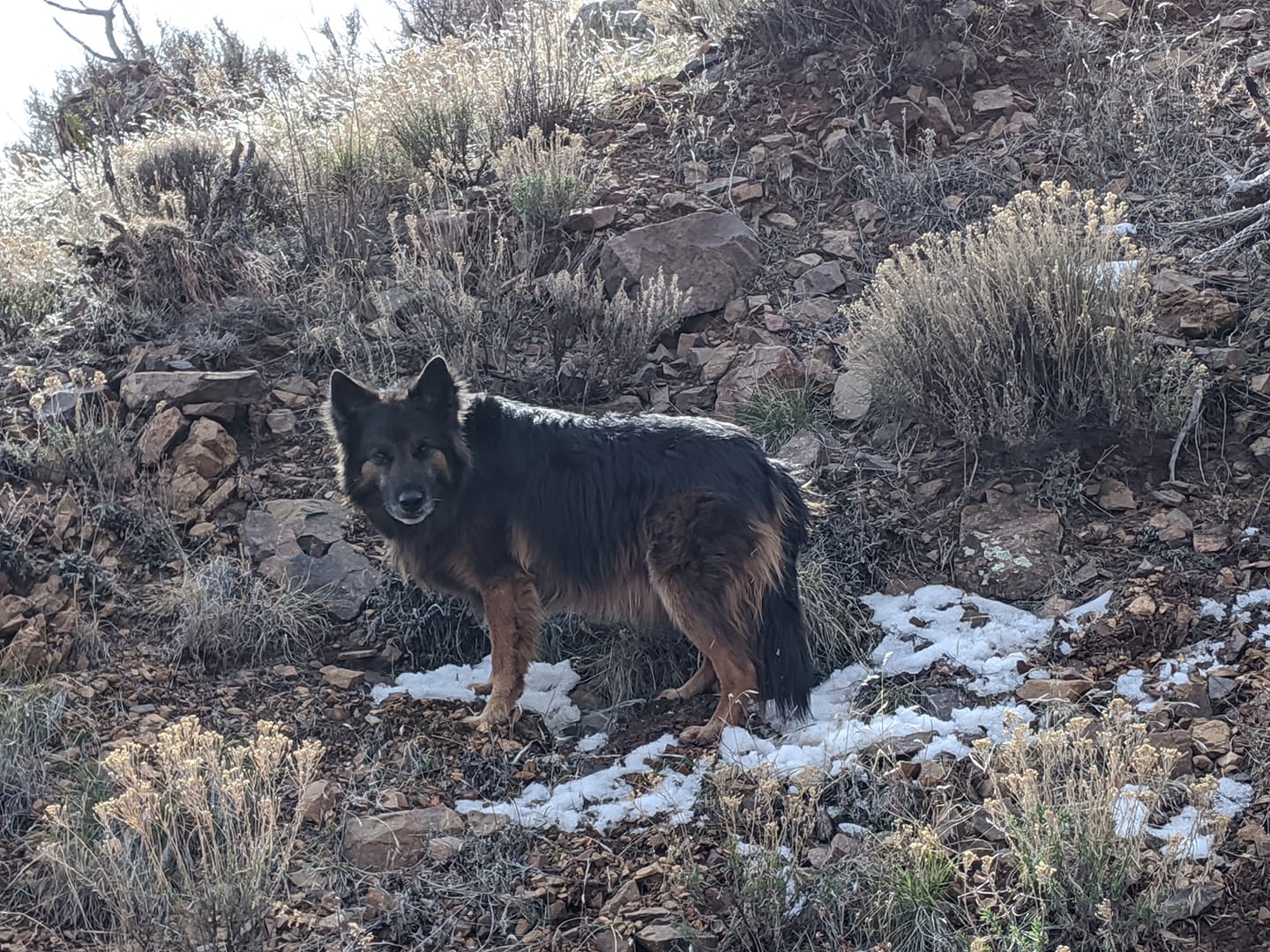
There were small pockets of icy snow on the north end of the trail. I stopped at each snow pack to let Zeke eat the ice. I had water with me, but I always prefer to use natural sources. Zeke was tired, it was obvious, and he slowed me down, but not once did he ever whimper or moan.
At the three-mile mark another view to the south opened up. Here the man ahead of me took a rest on an old log. Zeke approached him but he told me that dogs make him nervous, so I kept my distance from him. He then turned around and then it was just Zeke and I. A sign warning not to proceed on an unmarked trail going east because of unexploded ammunition got my curiosity. The sign was posted because this part of the mountain range was once the edge of a missile range and part of Fort Bliss' missile range all throughout the Cold War. El Paso Representative Ronald Coleman (D) fought to preserve this former range land as a park in 1987 and succeeded.

The trail going up at this point gets rockier and steep again and I stopped a few times to let Zeke munch on ice. A young couple came down as I was near the top. I could also see the remains of a pick-up truck off the trail. It had been heavily graffitied.

It took me 2:34 hours to reach the flattened peak, adorned with a 10-foot ham radio repeater. Zeke immediately sat in the narrow shade provided by this pole as I admired the view. It wasn't as windy at the top as I had feared, and the views south into Mexico were impressive. Weather was forecasted to reach 70F and be sunny, but there were enough wispy clouds to soften the sun. It turned out to be near ideal weather for this peak.
An ammo box with a registration book inside was next to the repeater, but also energy bars, gum, and a can of Pabst Blue Ribbon Light. I gladly took the gum, thanked the person who left this for others, registered my name and date, but kept the beer can for someone more desperate. Alcohol is not allowed in Texas state parks.

We rested for 30 minutes. Zeke was clearly tired and he needed to rest. These rocky and steep mountains took a toll on him, but he conquered them with me like a champ.

We went back the same way we came in, down the old mining road. The wind picked up again at Mundy's Gap, then calmed down again when we got below the gap. People were still starting out on this trail, despite the park's gate closing at 5pm. The large rocks on the trail in the beginning were no easier going down than it was going up. Both ankles were sore when I got back to my Honda.

An older gentleman, who I had seen behind me on the trail made it to the peak as I left the peak, He looked to be in his 70s. He would reach the parking lot just minutes after I got back to the car. Twelve more people were heading up the peak as I resumed the descent.

I got back to the car at 2:15pm. By now it was warm and I removed my sweat shirt. I was hungry and ate any left overs I had, watched park users come and go from the parking lot, and finally drove off at 3pm. My only stop was for gas at the closest Sam's Club, then drove home the same way I drove coming to El Paso, driving along NM9 and the border, watching a diffused sun set, spotting more border wall construction crews, and noting a few quirky roadside art. I got home at 8:15pm, threw my dirty clothes in the wash, saw a typed letter from our neighbors about our barking dogs, and went to bed. I'll deal with the letter tomorrow, when Kevin is awake and can help explain it.

No comments:
Post a Comment