Ryan and I must be the heathen hikers as no one else shows up for Sunday hikes.
We had an impressive rain storm late Saturday that finally drenched our yard and caused area flooding. Our water pressure had been weak, but it was back to normal when I got up at 4am to have breakfast and make coffee. The original hike for today was up Lone Mountain, in the southwestern part of the Huachucas. Due to flooding on the dirt road, we came up with hiking Split Rock Canyon instead, a canyon we had discovered on last week's hike up Blacktail canyon. This proved to be a lovely hike, as the weather was perfect for this, with an overcast sky, high humidity, and low chance of morning rains. As my first time on this moderate trail, it also meant I was carefully looking at foliage and fauna along the way.
Hard to believe that in ten years, I have never hiked up this canyon.

On a hot or clear day this first 1.4 miles would be very hot, as the sun reflects off the sandy, exposed road. We passed a rusty gate, a large boulder graffitied with spray paint, and elevation soon increased as the road took a curve into the canyon and became rockier and more rutted.

An old brown sign at the actual trail head is hidden in the trees, pointing to various landmarks along the way: Split Rock Saddle 1 3/4 mile, and both TV Hill and Blacktail Pond at 2 3/4 miles away.
"Let's go to Blacktail Pond!" I suggested, as that would be ideal for the dogs. It's a landmark I've been wanting to see for five years. I wanted to see this elusive pond once and for all. Ryan, who had already hiked up to TV Hill, was OK with this choice. It was a fine choice indeed as we quickly began to increase in elevation during what we called an "exploratory hike" to a place neither of us had ever been to.


The trail wasn't too muddy despite last night's rain, but the trail that was in the shade provided a cool relief for the dogs who were now wanting water. We could hear a creek nearby, but were too high up to venture back down into a steep draw to explore. We came across a small waterfall at the mile mark, where we sat and rested for a bit while the dogs drank. This was a lush section of the trail. Last night's rain gave this waterfall extra volume as its mist spread out on the ground.

We took a snack break here so that the dogs could also drink without feeling pressured to continue hiking. Otherwise the dogs would just follow us without drinking much. Neither dog will drink much unless I force them to, telling them to "Drink the water!" rather than "Pick up that stick so I can throw it for you!" which are words Minnie would much rather hear from me.

We spotted red coralbell(Heuchera sanguinea), which I erraneously thought were wild geraniums, perhaps the only flower we didn't see last week in the lower section of Blacktail Canyon. Its flowers were on the top of long, leafless stems that protruded from the more ground-level bunch of leaves. We only saw one sample, growing in the lush ground in the shade.

Not too far, climbing over one of several decaying logs along the trail, I came across a blue fungus beetle that was relaxing on a rotting Douglas fir snag. Other than the various calls from birds, we didn't see much else in the form of wildlife. Perhaps the animals kept hidden because of the dogs. What we did see quite a bit was lichen-covered oaks, or fungus growing on decaying logs in the northern slopes, on trees at times dangerously leaning far into the steep slopes of the canyon.


There was very little trash on this trail. We missed one switchback and ended up following the drainage to the Blacktail Ridge trail. We walked through a hidden camp that illegal border crossers had used, with weather-worn backpacks and rusty Jumex cans strewn in the foliage, but this was our one trashy area. We left the trash there, which was not too far from the trail we needed to continue on toward the pond.
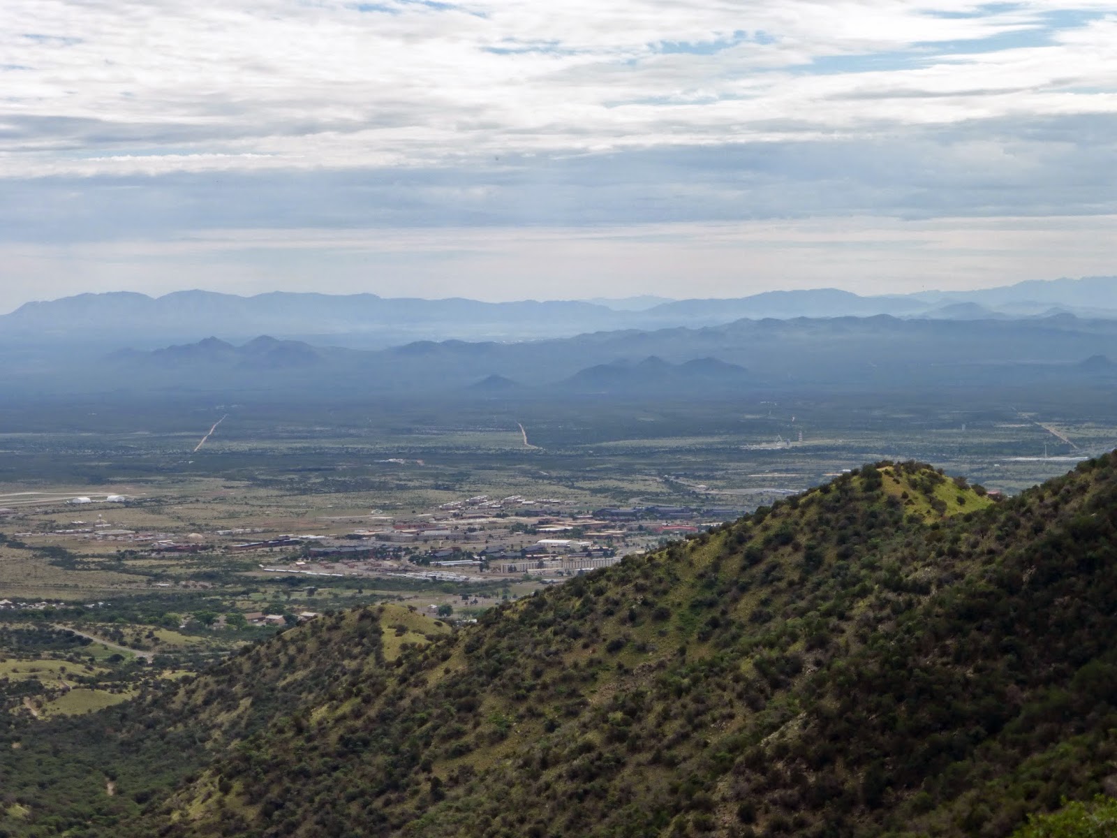
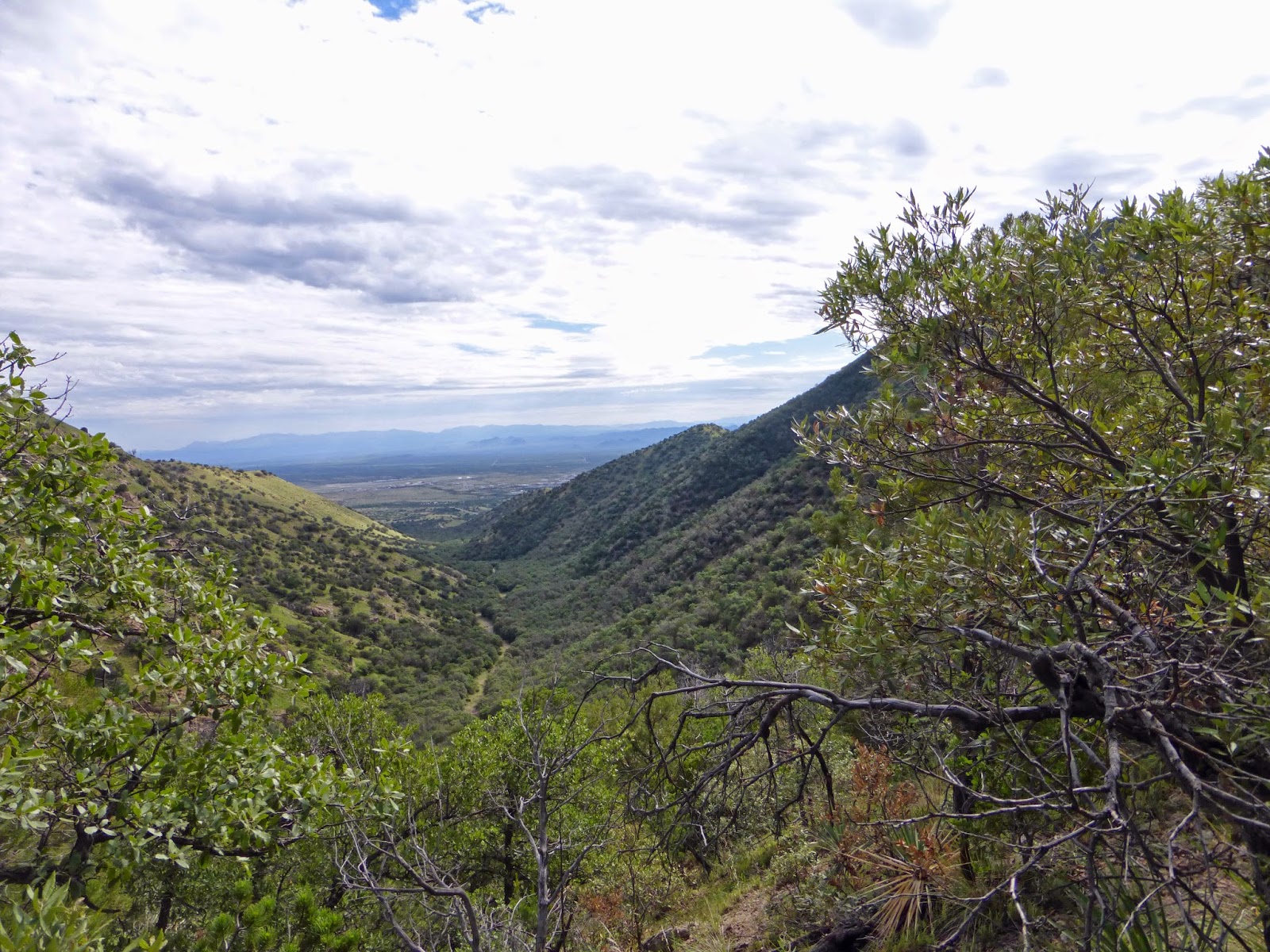
You don't get these kinds of views from other peaks in the Huachucas.


Ryan's cellphone would occasionally speak to him in a female voice, telling us that we had walked so many miles in a certain amount of time, averaging a certain pace. Neither one of us was in any hurry, as we both stopped to take photos or comment on a certain peculiar scene.
We were now on a ridge that followed Blacktail Canyon and its granite snags in the lower slope. The ridge line wasn't a wide ridge line, studded with oaks, and pines, which therefore afforded us several vistas. The highest elevation we reached was 7,428 feet, just before another sign pointed downhill to the pond that was our destination.


There are two small creeks that flow into this pond from two different directions. The pond is formed by an earthen dam, perhaps to avoid flooding in Blacktail Canyon, near where the US Army has several testing facilities and training sites. Two overgrown, wider trails merge here, perhaps former mining trails, providing the ideal resting spot for hikers and passers-by. A few old shoes littered the shore, but it wasn't too disturbing to see. Ryan rested on a rock and I on a nearby log as we ate our lunch. My lunch consisted of a small package of "Zesty Barbeque" chicken wings from Fry's Food, since I was in no mood to create a more elaborate lunch for me this morning. I gave the dogs the bones.

We rested at this pond for 45 minutes. The dogs never rested, as they wanted to play fetch the entire time. Minnie is clearly a water-loving dog, never wanting to sit and just nap during a break like most normal dogs do. Sadie would prefer to rest, but Minnie eggs her on to play, so she always relents. This also means that us humans don't get a break from her, either. She will drop her stick in front of me and wait patiently for me to pick it up and throw it. When that doesn't work, she begins to get restless and starts whining.

The pond is a very restful place to make as a hiking goal, with or without dogs. I'd love to come back here, perhaps try an approach from any of the other trails that merge here. This is a secluded pond that's not easily reached by the average forest walker; getting to this pond takes some effort.
We finally resumed our return hike at 11:15am, returning the same way we came. Skies were now starting to clear up, the humidity decreased, but the heat also started to pick up. As long as we were on the trail, this wasn't so bad, but the last 1.4 miles on the jeep trail in the valley was very hot for the dogs and us.
We got back to the cemetery parking lot and the truck at 1:27pm. The dogs gladly jumped into the truck where they took over the back seat, panting all the way home.
Hiking stats (taken from Ryan's Garmin GPS):
Time: 5 hr 44 min
Distance: 8.3 mi
Total Ascent: 2,533 ft
Total Descent: 2,529 ft
Max Elevation: 7,428 ft
Min Elevation: 5,207 ft
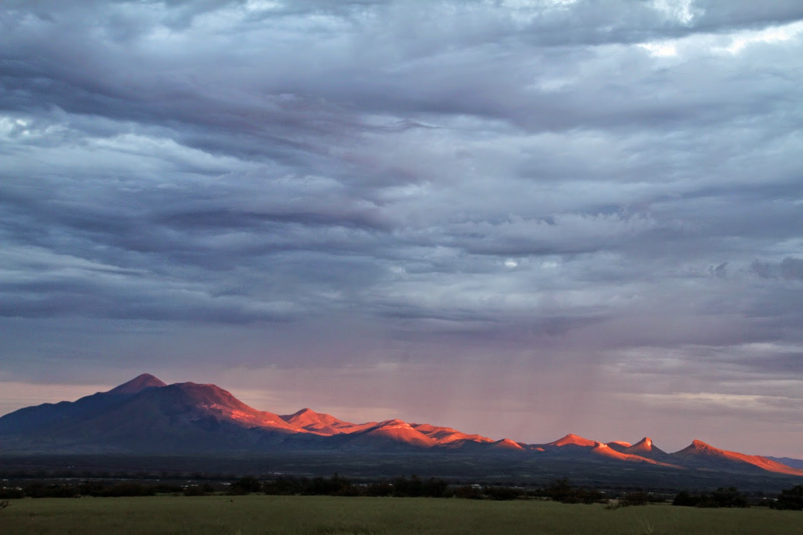
Four hours after arriving back home, I took all four dogs out for a much shorter walk to see the Super Moon rise. That turned out to be a dud thanks to storm clouds across the horizon. I did manage a nice shot of golden red hues along San Jose Peak at the international border, a peak that I dearly love. Sadie and Minnie showed no sign of fatigue, and Zeke and Sammy enjoyed getting out, sniffing and peeing on the grass and being dogs.
Awesome! Makes me want to go find the pond!
ReplyDelete