Saturday, October 30, 2010

Carr Peak in October


Today's hike up the peak was a windy blast. Ellen had asked if I wanted to hike up the peak with her a few days ago. Since I didn't hike up the summit last week, I immediately said yes. Like she said, this peak is close by, one gets a work-out and one still has most of the day ahead of them. This was also a great way to get my monthly trek up this summit out of the way.

There were three of us: Ellen, her friend Otto, and I. A fourth person never showed up.

We got to the trailhead just before 9am. The colors were clearly past their prime. The aspens were naked and the ash were now in their yellow hues. Many of the ebony oaks were brown. Columbines were edged in red. The salvias were gone. In fact, we saw very little wildlife except for a few butterflies. No raptors, no rodents. Just lots of people wanting to get to the peak or to Miller a few more miles away.

The wind picked up 1/2 mile from the peak. Ellen and I had to hold on to our hats as we scurried up to the summit. The AmeriCorp workers from last month had cleared all the downed trees for us, which made getting to the top a lot easier.

Several young people were at the summit. The gal took our photos. They were on their way up to Miller Peak, making their hike 12+ miles.

Ellen and I agreed to get together before the end of the year and tackle Miller peak. From the upper Reef campground it's a 12-mile hike to Miller Peak. I'd like to get it done in November before it gets too cold. I'm stoked to have found a like-minded woman who hikes at my pace and who enjoys getting out even for last-minute hikes. Even Otto seems to be a strong hiker and I'm sure I'll see him again.

I met Jeffrey on the way down. He and his wife Cyndi had joined me and several others up the Marshall Gulch trail in August. Today he was going to the peak with another man, but Cyndi was at work and the black lab stayed at home.

We made it back to our cars around 12:10pm, so the entire hike was no more than three hours long. Now that's what I call a work-out.

Sunday, October 24, 2010

East Hunter Canyon Trail


Distance: 3 miles
Elevation: 5900-6900'
Time: 2 hours, leisurely pace

This is a short trail built in the 1980s by a local Girl Scout troop. It ends in a lush canyon of an old homestead a mile from the Miller Wilderness sign. I don't even think it's an official trail anymore except for illegals who come down the canyon from the Crest Trail. It's steep and scenic and today I took all three dogs with me because I didn't have the heart to leave Sara and Sammy behind.

Fall colors are in full bloom along the Crest Trail, but we didn't get that high up. The actual trail ends a mile uphill, but we continued up the illegal trail that follows the steep dry creek bed. We passed a lot of Mexican trash that I took back down with me. We didn't get too far due to downed trees and large boulders blocking the way, but I was able to take a few autumn shots anyway. We went only as far as we could safely go. Even Sara had trouble pushing herself up some of the tall, steep boulders but she made it, and when at one point none of the dogs followed me up the steep embankment, I realized it was time to turn around.

It was a pleasant fall weekend, but I spent most of it studying for my English class. Today's little jaunt was just a leg stretcher up a little path few venture up.

It's actually the only safe place now that hunting season's in full swing and all the lower trails are taken by drunk hunters spying for game out of their truck windows. But even in the higher elevation one has to be careful because I found a few brass shells at the trailhead parking area.

Weather is still so lovely during the day, in the 70s, although the nights are now creeping into the 40s. I had to wear socks the last two nights to keep my feet warm.

Sunday, October 17, 2010

Bear Creek going south


I took the morning and mid afternoon off from my English midterm to hike with Kevin down Bear Creek. This is a pretty time to do so with migrating raptors and other wildlife.

The drive there via Forest Road 61 started out eventful: a few miles from our destination and we were stopped by at least six USBP vehicles, a sheriff's SUV and a large tow truck. I figured we had come across a large group of illegals that had driven their car down the embankment. That was not the case. A young woman had driven her black Jeep down the embankment at 5am when she tried to get around a USBP truck that was dragging tires behind it. We were only stopped for about ten minutes, but that was enough to get all three dogs restless.

I enjoy this walk down Bear Creek. There was plenty of water in the creek, more than last year. For three miles one can walk the dogs without worrying about them becoming dehydrated. There's plenty of shade as well.The only people we encounter here are illegals following the creekbed.

The creekbed looked like it had seen some serious flooding during the monsoon. Part of the illegal trail had been washed away. Plenty of grass had grown and now gone to seed. It was that seed that got stuck to my socks and fell inside my shoes that felt like porcupine quills pressing against my skin.

We saw little wildlife except cows and a few disgruntled bluejays.I didn't mind so much as just being here is refreshing. Few trees were even showing signs of autumn.

TBC

Friday, October 15, 2010

Lutz Canyon Trail


Distance: Almost 7 miles.
Elevation: 5890'-8650'
Time: 4.5 hours

Last night, while mentally organizing a term paper on George Eliot, Brenda called. She wanted to know if I could join her and two of her friends for a quick hike up Lutz Canyon. "We'll be done by noon" said Brenda. Since I'm on fall break from the school this week, I bit.

Rain was forecasted for today, so I was a little unsure about hiking. Last night I saw lightning behind the mountains while walking the dogs at 8pm. This morning there were some low-lying clouds before sunrise, but by the time we met at 7:15am, the skies were clearing. We had blue skies with partial cloud cover all morning. Weather couldn't have been better.

We were four: Brenda, Debbie, Ellen and I and dogs Sadie and Chalita. We started the steep trail at 7:30am, hiking up at a steep pace, stopping only twice briefly to water the dogs, and made it to the Crest Trail just before 10am. The loose rocks in the lower half of this trail made the footing treacherous. It was worse going down. Two of us also carried firearms, as the Lutz trail is notorious for drug caches and illegal hideouts (because of the many small, abandoned caves along the trail).

This is the kind of workout I needed: a pace and distance that challenged me without killing me...or keeping me waiting. We all hiked up this trail at the same pace. I stayed in the back to talk with Ellen, but found myself out of breath. Am I losing the conditioning I gained hiking the JMT this past July?

We stopped briefly at the Lutz mine, took a few photos, checked out the entrance to the mine, then resumed the steep grade up to the Upper Bear Mine, where more Mexican trash lingered. This site wasn't as bad as my last hike this way in January 2009, but it was obviously recently used as an illegal resting spot for those coming up from Mexico. Several sun-burned backpacks hung abandoned on a dead tree. We took those down and carried them in a trash back on our return hike, taking turns carrying the bag.

We stopped a few times to enjoy the view. We arrived at the Crest Trail just before 10am, where we rested for 30 minutes before going back down again. There were few trees except for some ash trees in fall splendor. Water that was in the creek earlier this year was all gone. This was a dry hike. We never met another soul on the trail.

We got back to the cars just before noon, ate lunch at Vinny's in town where we chatted another 45 minutes. The gals were talking passionately about caving and seemed to want to recruit me on a spelunking trip with them. I told them they sounded like smooth-talking army recruiters. Caves scare me, but this group of women would put me at ease...and the idea is tempting!

I got home at 1:45pm with a large cheese pizza for Kevin. This was perfect for me as I had the rest of the day to get homework started. An hour later the skies turned grey, the wind kicked in, and just before sunset it began to rain. The forecasters were right after all.

Tuesday, October 12, 2010

Bear Canyon and the Arizona Copper Corporation


A Canadian mining company calling itself the Arizona Copper Corp, a British Columbia based mineral exploration company focusing on base metal porphyry deposits in North America, incorporated in May 2007, is asking the Coronado National Forest for drilling rights in the national forest. It already has 34 mining stake claims in Bear Canyon. Experimental ore drilling has already begun. Now it wants the go-ahead from the National Forest Service to begin mining for this ore, which of course said OK but not until a public awareness program has been conducted and citizens' opinions have been collected. That part was completed 1 October 2010.

This company claims that since the price of copper has risen to $1300 a ton it is now profitable to mine here for copper, silver and gold. Bear Canyon is on the southern slopes of the Huachuca Mountains, just a few miles from the Mexican border, and out of sight of the populated area around Sierra Vista.

The General Mining Act of 1872 is still in effect, granting any prospector rights to mine anywhere on federal land. Although this old law has been proposed for changes in both 2007 and 2009 with the Hardrock Mining and Reclamation Act, neither Republicans or Democrats want to reform this old act. And no Arizona politician has brought this up for the upcoming November election. This amendent would make a 2% to 5% tax mandatory and mining companies are balking.

According to the Arizona Copper Corporation Executive Summary, it sees no problem with drilling here. The summary claims

Since the discovery in 2007, four zones of primary copper with associated silver and gold mineralization
have been outlined utilizing prospecting, geological mapping, and I.P. ground geophysics. Each of these
zones measures approximately 1 mile in diameter. The geological model of the Bear Canyon project is a
classic buried porphyry, protected from erosion, at an indicated depth of 150 metres. Many factors
related to the Bear Canyon project indicate that it offers a highly prospective target for copper-silver
mineralization. These factors include the mining history of the district as well as tonnage and grade
potential as indicated by recent exploration.

A Phase I diamond drilling programme is planned for the spring of 2010. Permitting has been started for
an initial 8 holes with an initial target depth of 250-400 metres each. Following the planned drill
program, further geophysics, prospecting, additional work on other targets, along with continued drilling
will proceed.


These claims most likely come from the company's "Review of Technical Information and Proposed Exploration Program for the Bear Canyon Property," authored by geologist Carl von Einsiedel who writes, "there are no known existing environmental liabilities to which the property is subject" and adds "there are numerous small streams within the claim area that would easily provide sufficient water for exploration purposes" of which one is Bear Creek, although it is not mentioned by name in the review. Bear Creek is the only reliable creek in the area; the others are seasonal. This would put the strain on Bear Creek alone. Copper and Sycamore creeks are nearby, but water from those creeks would have to be piped in.

We decided to walk around this disputed area and see the area before this beautiful canyon potentially gets torn up. We took all three dogs with us since we weren't planning on hiking for long. This was an "exploratory hike."

As expected, we met no other hikers but we did come across Mexican trash. I picked up all the plastic bottles I could on our return hike down Wakefield Mine trail.

There are several ATV and forest roads that border the area the Arizona Copper Corp wants to lease. Forest Road 4772 is the main road off Forest Road 61 which skirts the Huachuca Mountains and the border. The other road is FR4772 to its eastern boundary. Everything between these two roads will soon be drilled for copper and if enough is found there, the AZCopperCorp will rip this land open for their own profits, polluting the beautiful Bear Creek drainage that we've enjoyed hiking along in the fall. This Bear Creek is known for its raptors and other wildlife, and is used by nearby cattle, both US and Mexican. Because the creek flows south into Mexico the company is not concerned with environmental damages, although the creek is part of the Bear Creek riparian restoration project and Bear Creek is part of the San Pedro River watershed, the last remaining free-flowing "river" in Arizona. (This river flows into the Gila River in eastern-central Arizona.)

There is no such thing as an unpolluted river once mining operations are used for the water; the vast majority of Super Fund sites are caused by mining companies, chemical plants and military bases (jet and vehicular fuels) that have long ago declared bankruptcy to avoid paying any damages. According to the latest National Priorities List for Super Fund sites, there were 1279 such sites registered. Arizona belongs to Region 9, the Pacific southwest, the same region in which California, Nevada and Hawaii also belong. Cochise County here already has a Superfund Site thanks to the Apache Power Company, a nitrogen plant, southeast of Benson, which also is located on the San Pedro river.

So what about the water in Bear Creek? The Clean Water Act of 1972 covers only "regulating discharges of pollutants into the waters of the United States" but not discharges into Canada or Mexico. The CWA also makes it "unlawful to discharge any pollutant from a point source into navigable waters...unless a permit is obtained."

Because Bear Creek is the first canyon that illegals entering the US from this area see, this area also receives a heavy litter problem. The US Border Patrol frequents this area to catch drug smugglers coming across, so there are dangers to having any sort of long-term operation here. Would the AZCopperCorp help with the clean-up of the surrounding litter?

And who will be charged with clearing the trees and grading the roads? Will local taxes be raised to support a foreign company's operation? And what about the alleged Upper San Pedro District? This district is being proposed on the next election ballot to "implement measures to conserve, reuse, recharge and augment water within the San Pedro River's Sierra Vista Subwatershed with the goal of maintaining the conditions needed to sustain the Upper San Pedro River and to assist in meeting the water supply needs and water conservation requirements for Fort Huachuca and the communities within the district."

Bear Creek where we wandered around is studded with oaks, alligator junipers, agaves, sotols and mesquites. One can see the northern Sierra Madres from here. Back in the 1880s this area was already mined with the Wakefield mine, and that mine still remains, left open for anyone to explore.

Just because the Arizona Copper Corp has the right to explore for ore here doesn't guarantee that the company will get the right to mine for it later. So we'll see. I personally see too many loopholes and too many issues with water availability and water quality for this company to take over the southern Huachucas.

http://azcoppercorp.com/
http://yosemite.epa.gov/r9/sfund/r9sfdocw.nsf/7508188dd3c99a2a8825742600743735/510f2916dad8646e88257007005e9402!OpenDocument

Sunday, October 10, 2010

Huachuca Peak


Distance: 9 miles
Elevation: 5500'-8410'
Time: 9+ hours

I hadn't done this hike in five years, and the last time was with Kevin and two very much younger dogs. It was time to hike this summit again. I summited this yesterday.

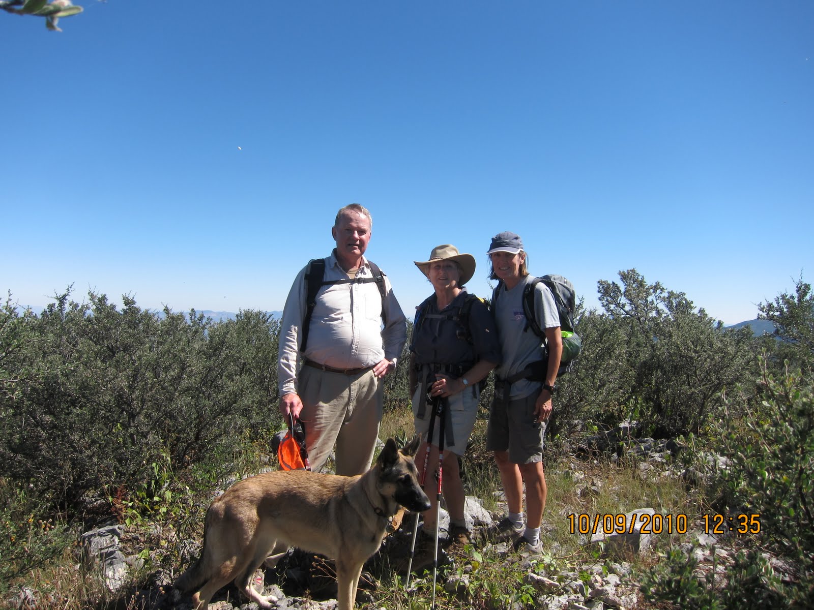
Big Steve and Hannah showed up for this hike. I was surprised only two showed up since several other members had been wanting to do this hike. Maybe word got out that I was going up this peak via the steep side. I had forgotten how steep this was, but I hadn't forgotten how pretty it was.

Kevin went out hunting in the Patagonia area and took Sammy with him. I had planned on taking Sadie along but Sara insisted on coming along as well. She ran outside with Sadie who immediately took the back seat. With all three dogs outside and all three confused as to where we were going and what was going on, I broke down and took Sara with me. The thought of leaving her home alone without her best pal Sammy with her would have been cruel.

Sara did better than expected although she got tired several times on the return hike and I had to rest with her. But she did the entire hike and didn't slow us down too much. I was so proud of her. Her only problem was her pungent gas! She kept farting as we went uphill. Luckily I was ahead of the other two so that they weren't exposed to the toxic fumes.

The hike starts out in McClure Canyon, an unmarked canyon off Garden Canyon Road. If you don't know it's there, it's easily missed. It's the first right passed the road gate, up a jeep road for almost a mile before it hits a T intersection. From there one turns left into the canyon popular with birders. Except today we didn't hear one bird. Bees and butterflies, however, were today's amusement.

Hannah had to stop a few times because she was feeling queasy and had a headache. It almost looked like we were going to have to cut the hike short, as she repeatedly complained of the steepness. I honestly didn't think this trail was so bad, and I certainly don't remember it being steep (although Kevin later on back home said that was the first thing he remembered)

The first mile is on an exposed maintenance trail with large rocks. The dogs found comfort in a nearby drainage. This is not a level hike by any means, and the further up we went, the steeper it got.

"I hiked up here before and we came to a wall and turned back!" said Hannah, remembering this hike, but I couldn't for the life of me remember any "wall." But trails do change over the years. There was a new trail sign pointing to the McClure Canyon Trail 1.33 miles uphill that Steve and Hannah pounded back into its post holes. The sign was bent in the middle. The rest of the 1.33 trail from that vantage point looked more like an illegal trail through heavy brush, but this is where I remember the trail leading to.

The trail gets pretty here as it enters the deep ravine of McClure canyon. There wasn't much water here, but after a heavy rain this would be a beautiful area to observe wildlife, if the hiker doesn't mind the strenuous hike to this point. Bare limestone exposed the remnants of an intermittent waterfall. Two small pools remained, and it was this pool that delighted Sara going up and then back down the peak. This water probably kept her from dehydrating. I had a gallon of water for the dogs.

The trail through this canyon is heavily overgrown. Thornybrush, sotols, agaves and young oak trees are now taking over. My knees were heavily poked by the time I got done with this hike. But what I like about this trail is that it doesn't switchback much: the narrow trail just goes up the steep canyon and hugs the foot of Huachuca Peak, which by now comes out as a giant volcanic outcrop in the range.

I only lost the trail once briefly, but we were able to get back on the faint trail.

We stopped at the intersection at Pine Park (7600')and an old helispot. Sara needed the break. We sat there for a good half hour, and I was prepared to turn around here for the sake of the others, but then Hannah said the magic words "Well, shall we?" and decided she had rested well enough to make it to the summit now just a mile away, according to the faded forest sign. Yay!

I remember this last mile being exposed, but in five years many of the young oak trees had grown tall enough to provide shade. Only the very top was exposed as we moved through thick strands of young oak and thornybrush. We had a beautiful view from the top, but Carr Peak hid the view of Miller Peak. Other peaks in the area, though, were quite visible: Mount Wrightson, Mount Lemmon, the Whetstones and the Santa Cruz valley to our west. This was a view I hadn't seen in a while.

We sat on the cement foundation of an old look-out tower now long gone. The cement blocks were the only level (and comfortable!) seating arrangements here. We drank our water, Sara rested, and it was back down the way we came. Both dogs by now were tired and had slowed down, and Sara sat down several times to catch her breath. I always let her rest a few minutes, but after telling her "Let's go!" she obediently got up to continue.

Sara and Sadie got along very well today. They didn't fight over the Alpha spot and provided good company for each other. It had been a while since the "girls" were together like this. Except for Sadie barking at Hannah at our meet-up spot, the dogs behaved very well.

This was a long hike due to the slowness of our pace, but I still enjoyed the trail. I hadn't been in the Garden Canyon area in quite a while and forgot how pretty some of the side canyons are. The road closure probably added two extra miles to this hike. My hiking guide isn't very clear as the exact mileage of today's hike because the trail doesn't even officially start until that first sign we passed, pointing 1.3 miles to the Crest Trail. My estimates had this at an eight-mile hike, but we went over nine miles considering we had to walk up and back down that first jeep trail.